Area Overview for B27 7SG
Photos of B27 7SG
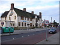
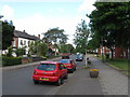
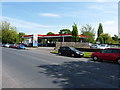
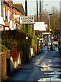
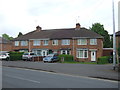
27 photos from this area
Area Information
Key information about the B27 7SG including its size, population, and administrative classification.
- Area Type
- Postcode
- Area Size
- 4866 m²
- Population
- 1652
- Population Density
- 6737 people/km²
House Prices in B27 7SG
10
Properties
£138,900
Average Sold Price
£63,500
Lowest Price
£260,000
Highest Price
Showing 10 properties
| Address | Type | Beds | Baths | Last Sale Price | Last Sale Date | |
|---|---|---|---|---|---|---|
| 87 Fox Green Crescent, Birmingham, B27 7SG | Terraced | 3 | 1 | £260,000 | Aug 2024 | |
| 83 Fox Green Crescent, Birmingham, B27 7SG | Semi-detached | 3 | 1 | £170,000 | Feb 2019 | |
| 75 Fox Green Crescent, Birmingham, B27 7SG | house | 3 | - | £99,950 | Jun 2013 | |
| 69 Fox Green Crescent, Birmingham, B27 7SG | Semi-detached | - | - | £120,000 | Nov 2007 | |
| 67 Fox Green Crescent, Birmingham, B27 7SG | house | 2 | - | £119,950 | Jul 2007 | |
| 57 Fox Green Crescent, Birmingham, B27 7SG | Semi-detached | 3 | 1 | £63,500 | May 2000 | |
| 77 Fox Green Crescent, Birmingham, B27 7SG | Terraced | 3 | 1 | - | - | |
| 61 Fox Green Crescent, Birmingham, B27 7SG | Semi-detached | - | - | - | - | |
| 59 Fox Green Crescent, Birmingham, B27 7SG | house | - | - | - | - | |
| 89 Fox Green Crescent, Birmingham, B27 7SG | house | - | - | - | - |
Energy Efficiency in B27 7SG
Amenities
Schools
| Rank | School | Type | Entry gender | Ages |
|---|
Explore more schools in this area
Go to Schools tabDemographics
Household Size
One person
most common
Accommodation Type
Houses
most common
Tenure
40
majority
Ethnic Group
White
most common
Religion
N/A
most common
Household Composition
N/A
most common
Age
47
median
Adults (30-64 years)
most common
Household Deprivation
N/A
with no deprivation
NS-SEC
17
in Lower managerial occupations
Explore more demographic insights in this area
Go to Demographics tabPlanning
Planning Constraints
- Flood RiskPremium
- Ramsar Wetland SitesPremium
- Area of Outstanding Natural BeautyPremium
- Protected Nature ReservePremium
- Protected WoodlandPremium