Area Overview for B27 7AN
Photos of B27 7AN
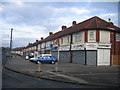
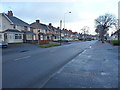
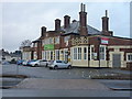
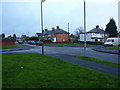
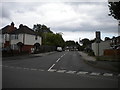
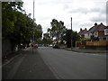
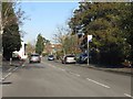
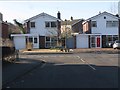
17 photos from this area
Area Information
Key information about the B27 7AN including its size, population, and administrative classification.
- Area Type
- Postcode
- Area Size
- 6974 m²
- Population
- 1685
- Population Density
- 4044 people/km²
House Prices in B27 7AN
31
Properties
£133,000
Average Sold Price
£42,000
Lowest Price
£276,000
Highest Price
Showing 31 properties
| Address | Type | Beds | Baths | Last Sale Price | Last Sale Date | |
|---|---|---|---|---|---|---|
| 374 Gospel Lane, Olton, Solihull, B27 7AN | Semi-detached | 3 | 1 | £276,000 | May 2022 | |
| 388 Gospel Lane, Olton, Solihull, B27 7AN | Semi-detached | 3 | 1 | £200,000 | Nov 2019 | |
| 386 Gospel Lane, Olton, Solihull, B27 7AN | house | 3 | - | £121,000 | Apr 2013 | |
| 362A Gospel Lane, Olton, Solihull, B27 7AN | Flat | 2 | 1 | £150,000 | Mar 2013 | |
| 396 Gospel Lane, Olton, Solihull, B27 7AN | Semi-detached | - | - | £87,000 | Sep 2002 | |
| 382 Gospel Lane, Olton, Solihull, B27 7AN | house | - | - | £55,000 | Jul 1999 | |
| 394 Gospel Lane, Olton, Solihull, B27 7AN | Semi-detached | - | - | £42,000 | Dec 1997 | |
| 370E Gospel Lane, Olton, Solihull, B27 7AN | Maisonette | - | - | - | - | |
| 370D Gospel Lane, Olton, Solihull, B27 7AN | Flat | - | - | - | - | |
| 370C Gospel Lane, Olton, Solihull, B27 7AN | Maisonette | - | - | - | - |
Page 1 of 4
Energy Efficiency in B27 7AN
Amenities
Schools
| Rank | School | Type | Entry gender | Ages |
|---|
Explore more schools in this area
Go to Schools tabDemographics
Household Size
Family (3-5 people)
most common
Accommodation Type
Houses
most common
Tenure
77
majority
Ethnic Group
White
most common
Religion
N/A
most common
Household Composition
N/A
most common
Age
47
median
Adults (30-64 years)
most common
Household Deprivation
N/A
with no deprivation
NS-SEC
37
in Lower managerial occupations
Explore more demographic insights in this area
Go to Demographics tabPlanning
Planning Constraints
- Flood RiskPremium
- Ramsar Wetland SitesPremium
- Area of Outstanding Natural BeautyPremium
- Protected Nature ReservePremium
- Protected WoodlandPremium