Area Overview for B27 6SY
Photos of B27 6SY
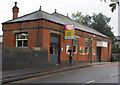


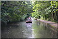
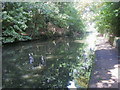
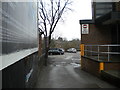

64 photos from this area
Area Information
Key information about the B27 6SY including its size, population, and administrative classification.
- Area Type
- Postcode
- Area Size
- 1.7 hectares
- Population
- 1895
- Population Density
- 6677 people/km²
House Prices in B27 6SY
83
Properties
£173,175
Average Sold Price
£89,232
Lowest Price
£410,000
Highest Price
Showing 83 properties
| Address | Type | Beds | Baths | Last Sale Price | Last Sale Date | |
|---|---|---|---|---|---|---|
| 106 Vine Lane, Birmingham, B27 6SY | Semi-detached | 4 | 3 | £162,000 | Aug 2025 | |
| 121 Vine Lane, Birmingham, B27 6SY | Flat | 2 | 2 | £150,000 | May 2025 | |
| 119 Vine Lane, Birmingham, B27 6SY | Flat | 2 | 2 | £149,000 | Mar 2025 | |
| 86 Vine Lane, Birmingham, B27 6SY | house | - | - | £255,255 | Mar 2025 | |
| 19 Vine Lane, Birmingham, B27 6SY | Flat | 2 | 2 | £158,000 | Nov 2024 | |
| 24 Vine Lane, Birmingham, B27 6SY | Flat | - | - | £150,000 | Sep 2024 | |
| 10 Vine Lane, Birmingham, B27 6SY | Detached | 4 | 2 | £410,000 | Jul 2024 | |
| 120 Vine Lane, Birmingham, B27 6SY | Terraced | 2 | 1 | £215,000 | Apr 2024 | |
| 21 Vine Lane, Birmingham, B27 6SY | Flat | 2 | 2 | £143,000 | Jan 2024 | |
| 110 Vine Lane, Birmingham, B27 6SY | Terraced | 4 | 3 | £255,100 | Nov 2023 |
Page 1 of 9
Energy Efficiency in B27 6SY
Amenities
Schools
| Rank | School | Type | Entry gender | Ages |
|---|
Explore more schools in this area
Go to Schools tabDemographics
Household Size
Family (3-5 people)
most common
Accommodation Type
Houses
most common
Tenure
65
majority
Ethnic Group
White
most common
Religion
N/A
most common
Household Composition
N/A
most common
Age
47
median
Adults (30-64 years)
most common
Household Deprivation
N/A
with no deprivation
NS-SEC
29
in Lower managerial occupations
Explore more demographic insights in this area
Go to Demographics tabPlanning
Planning Constraints
- Flood RiskPremium
- Ramsar Wetland SitesPremium
- Area of Outstanding Natural BeautyPremium
- Protected Nature ReservePremium
- Protected WoodlandPremium