Area Overview for B27 6SB
Photos of B27 6SB


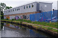
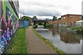
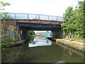

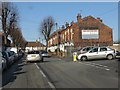
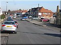
23 photos from this area
Area Information
Key information about the B27 6SB including its size, population, and administrative classification.
- Area Type
- Postcode
- Area Size
- 8970 m²
- Population
- 1895
- Population Density
- 6677 people/km²
House Prices in B27 6SB
27
Properties
£137,091
Average Sold Price
£56,000
Lowest Price
£245,000
Highest Price
Showing 27 properties
| Address | Type | Beds | Baths | Last Sale Price | Last Sale Date | |
|---|---|---|---|---|---|---|
| 40 The Vineries, Birmingham, B27 6SB | Terraced | 1 | 1 | £147,000 | Jul 2021 | |
| 26 The Vineries, Birmingham, B27 6SB | Detached | 3 | 1 | £245,000 | Aug 2019 | |
| 36 The Vineries, Birmingham, B27 6SB | house | - | - | £165,000 | Nov 2018 | |
| 14 The Vineries, Birmingham, B27 6SB | Semi-detached | 1 | 1 | £125,000 | Oct 2017 | |
| 7 The Vineries, Birmingham, B27 6SB | Semi-detached | 3 | - | £185,000 | Nov 2016 | |
| 29 The Vineries, Birmingham, B27 6SB | house | - | - | £175,000 | Mar 2014 | |
| 4 The Vineries, Birmingham, B27 6SB | house | 2 | 1 | £128,500 | Oct 2013 | |
| 15 The Vineries, Birmingham, B27 6SB | house | - | - | £157,000 | Sep 2013 | |
| 10 The Vineries, Birmingham, B27 6SB | Terraced | 1 | 1 | £90,000 | May 2011 | |
| 2 The Vineries, Birmingham, B27 6SB | Semi-detached | - | - | £137,000 | Jan 2007 |
Page 1 of 3
Energy Efficiency in B27 6SB
Amenities
Schools
| Rank | School | Type | Entry gender | Ages |
|---|
Explore more schools in this area
Go to Schools tabDemographics
Household Size
Family (3-5 people)
most common
Accommodation Type
Houses
most common
Tenure
65
majority
Ethnic Group
White
most common
Religion
N/A
most common
Household Composition
N/A
most common
Age
47
median
Adults (30-64 years)
most common
Household Deprivation
N/A
with no deprivation
NS-SEC
29
in Lower managerial occupations
Explore more demographic insights in this area
Go to Demographics tabPlanning
Planning Constraints
- Flood RiskPremium
- Ramsar Wetland SitesPremium
- Area of Outstanding Natural BeautyPremium
- Protected Nature ReservePremium
- Protected WoodlandPremium