Area Overview for B26 3BN
Photos of B26 3BN
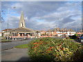
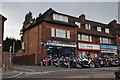
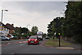
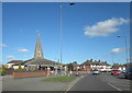
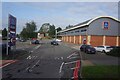
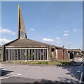

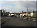
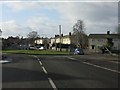
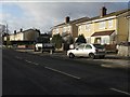
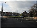

30 photos from this area
Area Information
Key information about the B26 3BN including its size, population, and administrative classification.
- Area Type
- Postcode
- Area Size
- 1.2 hectares
- Population
- 1900
- Population Density
- 5509 people/km²
House Prices in B26 3BN
33
Properties
£113,662
Average Sold Price
£30,000
Lowest Price
£208,000
Highest Price
Showing 33 properties
| Address | Type | Beds | Baths | Last Sale Price | Last Sale Date | |
|---|---|---|---|---|---|---|
| 63 Common Lane, Sheldon, Birmingham, B26 3BN | Semi-detached | 3 | 1 | £155,000 | Apr 2024 | |
| 65 Common Lane, Sheldon, Birmingham, B26 3BN | Semi-detached | 3 | 1 | £164,000 | Nov 2023 | |
| 11 Common Lane, Sheldon, Birmingham, B26 3BN | Retail | 3 | 1 | £192,000 | May 2022 | |
| 41 Common Lane, Sheldon, Birmingham, B26 3BN | house | - | - | £154,500 | Dec 2021 | |
| 49 Common Lane, Sheldon, Birmingham, B26 3BN | Semi-detached | 2 | 1 | £162,000 | Sep 2021 | |
| 7 Common Lane, Sheldon, Birmingham, B26 3BN | Terraced | 3 | 1 | £30,000 | Mar 2020 | |
| 67 Common Lane, Sheldon, Birmingham, B26 3BN | Semi-detached | 3 | 1 | £175,500 | Nov 2019 | |
| 37 Common Lane, Sheldon, Birmingham, B26 3BN | house | 3 | 2 | £84,000 | Nov 2017 | |
| 15 Common Lane, Sheldon, Birmingham, B26 3BN | Semi-detached | 2 | 1 | £65,000 | Oct 2017 | |
| 39 Common Lane, Sheldon, Birmingham, B26 3BN | Terraced | 2 | - | £105,000 | Mar 2015 |
Page 1 of 4
Energy Efficiency in B26 3BN
Amenities
Schools
| Rank | School | Type | Entry gender | Ages |
|---|
Explore more schools in this area
Go to Schools tabDemographics
Household Size
One person
most common
Accommodation Type
Houses
most common
Tenure
66
majority
Ethnic Group
White
most common
Religion
N/A
most common
Household Composition
N/A
most common
Age
47
median
Adults (30-64 years)
most common
Household Deprivation
N/A
with no deprivation
NS-SEC
26
in Lower managerial occupations
Explore more demographic insights in this area
Go to Demographics tabPlanning
Planning Constraints
- Flood RiskPremium
- Ramsar Wetland SitesPremium
- Area of Outstanding Natural BeautyPremium
- Protected Nature ReservePremium
- Protected WoodlandPremium