Area Overview for B26 2EH
Photos of B26 2EH
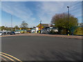
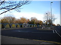
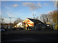
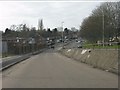
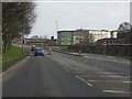
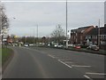
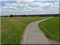
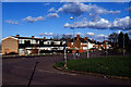
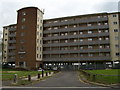
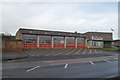
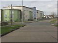
18 photos from this area
Area Information
Key information about the B26 2EH including its size, population, and administrative classification.
- Area Type
- Postcode
- Area Size
- 8711 m²
- Population
- 1735
- Population Density
- 5896 people/km²
House Prices in B26 2EH
32
Properties
£156,047
Average Sold Price
£85,000
Lowest Price
£240,000
Highest Price
Showing 32 properties
| Address | Type | Beds | Baths | Last Sale Price | Last Sale Date | |
|---|---|---|---|---|---|---|
| 63 Milstead Road, Birmingham, B26 2EH | Semi-detached | 2 | 1 | £198,000 | Jun 2025 | |
| 51 Milstead Road, Birmingham, B26 2EH | Terraced | 2 | 1 | £198,000 | May 2025 | |
| 29 Milstead Road, Birmingham, B26 2EH | Terraced | 2 | 1 | £177,000 | Nov 2022 | |
| 75 Milstead Road, Birmingham, B26 2EH | house | - | - | £150,000 | Nov 2022 | |
| 19 Milstead Road, Birmingham, B26 2EH | Terraced | 3 | 1 | £240,000 | Nov 2022 | |
| 27 Milstead Road, Birmingham, B26 2EH | Terraced | 2 | 1 | £186,500 | Mar 2022 | |
| 71 Milstead Road, Birmingham, B26 2EH | Semi-detached | 2 | 1 | £176,000 | Dec 2021 | |
| 77 Milstead Road, Birmingham, B26 2EH | Semi-detached | 2 | 1 | £163,750 | Apr 2021 | |
| 57 Milstead Road, Birmingham, B26 2EH | house | - | - | £153,000 | Jan 2021 | |
| 67 Milstead Road, Birmingham, B26 2EH | Semi-detached | 2 | 1 | £160,000 | Apr 2019 |
Page 1 of 4
Energy Efficiency in B26 2EH
Amenities
Schools
| Rank | School | Type | Entry gender | Ages |
|---|
Explore more schools in this area
Go to Schools tabDemographics
Household Size
Family (3-5 people)
most common
Accommodation Type
Houses
most common
Tenure
47
majority
Ethnic Group
White
most common
Religion
N/A
most common
Household Composition
N/A
most common
Age
47
median
Adults (30-64 years)
most common
Household Deprivation
N/A
with no deprivation
NS-SEC
15
in Lower managerial occupations
Explore more demographic insights in this area
Go to Demographics tabPlanning
Planning Constraints
- Flood RiskPremium
- Ramsar Wetland SitesPremium
- Area of Outstanding Natural BeautyPremium
- Protected Nature ReservePremium
- Protected WoodlandPremium