Area Overview for B26 1TF
Photos of B26 1TF
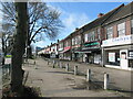
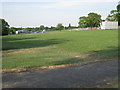

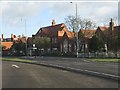
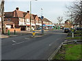
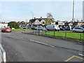
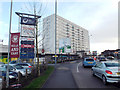
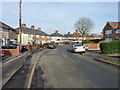
13 photos from this area
Area Information
Key information about the B26 1TF including its size, population, and administrative classification.
- Area Type
- Postcode
- Area Size
- 1.2 hectares
- Population
- 1597
- Population Density
- 3526 people/km²
House Prices in B26 1TF
56
Properties
£126,580
Average Sold Price
£43,050
Lowest Price
£200,000
Highest Price
Showing 56 properties
| Address | Type | Beds | Baths | Last Sale Price | Last Sale Date | |
|---|---|---|---|---|---|---|
| 72 Lily Road, Birmingham, B26 1TF | Terraced | 3 | 1 | £177,000 | Oct 2025 | |
| 6 Lily Road, Birmingham, B26 1TF | Terraced | 3 | 1 | £200,000 | May 2025 | |
| 12 Lily Road, Birmingham, B26 1TF | Terraced | 3 | 1 | £190,000 | Mar 2025 | |
| 66 Lily Road, Birmingham, B26 1TF | Terraced | 3 | 1 | £175,000 | Nov 2024 | |
| 84 Lily Road, Birmingham, B26 1TF | Terraced | 2 | 1 | £162,000 | Apr 2024 | |
| 44 Lily Road, Birmingham, B26 1TF | house | - | - | £145,000 | Apr 2024 | |
| 10 Lily Road, Birmingham, B26 1TF | Terraced | 2 | 1 | £178,000 | Feb 2024 | |
| 104 Lily Road, Birmingham, B26 1TF | house | - | - | £82,150 | Oct 2023 | |
| 54 Lily Road, Birmingham, B26 1TF | house | 2 | 1 | £161,500 | Aug 2023 | |
| 22 Lily Road, Birmingham, B26 1TF | house | - | - | £182,000 | Sep 2022 |
Page 1 of 6
Energy Efficiency in B26 1TF
Amenities
Schools
| Rank | School | Type | Entry gender | Ages |
|---|
Explore more schools in this area
Go to Schools tabDemographics
Household Size
One person
most common
Accommodation Type
Houses
most common
Tenure
47
majority
Ethnic Group
White
most common
Religion
N/A
most common
Household Composition
N/A
most common
Age
47
median
Adults (30-64 years)
most common
Household Deprivation
N/A
with no deprivation
NS-SEC
22
in Lower managerial occupations
Explore more demographic insights in this area
Go to Demographics tabPlanning
Planning Constraints
- Flood RiskPremium
- Ramsar Wetland SitesPremium
- Area of Outstanding Natural BeautyPremium
- Protected Nature ReservePremium
- Protected WoodlandPremium