Area Overview for B26 1AF
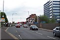
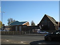
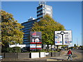
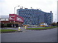
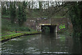
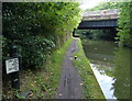
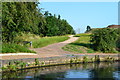
Photos of B26 1AF


Area Information
Living in B26 1AF means being part of a small, tightly knit residential cluster in east Birmingham. The postcode covers a compact area with a population of 1,597, positioned roughly 3.5 miles from the city centre. Historically part of the broader Yardley area, this region has evolved from medieval origins to a mix of 20th-century housing and modern infrastructure. The area is within the Yardley council constituency, a district that once spanned larger parts of the surrounding region. Daily life here is shaped by its proximity to transport networks, including multiple railway stations and the Birmingham International Airport. While the community is small, it is served by essential amenities, from local shops to schools. The area’s character blends residential tranquillity with accessibility to urban resources, making it a pragmatic choice for those seeking a balance between city convenience and suburban comfort.
- Area Type
- Postcode
- Area Size
- Not available
- Population
- 1597
- Population Density
- 3526 people/km²
B26 1AF is characterised by a housing stock that leans heavily towards owner-occupied homes, though 47% of residents rent, suggesting a significant rental market. The area is dominated by houses rather than flats or apartments, which is unusual for a city postcode. This mix may appeal to buyers seeking traditional family homes but could limit options for those preferring modern or smaller properties. The small size of the postcode means the immediate surroundings are key to understanding the property landscape. While the data does not specify property prices or availability, the focus on houses implies a market that may prioritise character and space over high-density living. Buyers should consider the area’s proximity to transport and amenities when evaluating its appeal.
House Prices in B26 1AF
No properties found in this postcode.
Energy Efficiency in B26 1AF
Life in B26 1AF is supported by a range of nearby amenities that cater to daily needs. The area has five retail outlets, including major names like Tesco Yardley and Farmfoods Yardley, ensuring easy access to groceries and household essentials. For transport, residents can utilise five railway stations, such as Acocks Green and Tyseley, which connect to Birmingham’s broader network. The proximity to Birmingham International Airport and metro points like Corporation Street enhances mobility for both commuters and travellers. While the area lacks detailed information on parks or leisure facilities, the presence of these practical amenities suggests a focus on functionality over luxury. The combination of retail, transport, and accessibility to urban hubs makes B26 1AF a pragmatic choice for those prioritising convenience in their daily lives.
Amenities
Schools
The nearest school to B26 1AF is the East Birmingham Network Academy, which is categorised as an ‘other’ school type. No specific Ofsted ratings or academic performance data are provided in the dataset, so prospective families must seek additional information to assess its quality. The absence of other schools in the area suggests limited options for parents, which could be a concern for families requiring multiple educational choices. However, the presence of a single school may indicate a focused local community with established ties to the institution. Those considering B26 1AF should investigate further into the school’s facilities, curriculum, and student outcomes to gauge its suitability for their children’s needs.
| Rank | School | Type | Entry gender | Ages |
|---|
Explore more schools in this area
Go to Schools tabDemographics
The population of B26 1AF has a median age of 47, with the majority of residents falling into the 30-64 age range. This suggests a community of working-age adults, many of whom may be established professionals or families. Home ownership rates stand at 47%, indicating that nearly half of residents rent their homes, which could reflect a mix of owner-occupied properties and rental stock. The predominant accommodation type is houses, which is uncommon in urban areas, hinting at a more suburban layout. The predominant ethnic group is White, though no specific data on diversity or deprivation is provided. The age profile and ownership figures suggest a stable, mature community, but the lack of detailed diversity metrics means the full demographic picture remains incomplete.
Household Size
Accommodation Type
Tenure
Ethnic Group
Religion
Household Composition
Age
Household Deprivation
NS-SEC
Explore more demographic insights in this area
Go to Demographics tabPlanning
Planning Constraints
- Flood RiskPremium
- Ramsar Wetland SitesPremium
- Area of Outstanding Natural BeautyPremium
- Protected Nature ReservePremium
- Protected WoodlandPremium