Area Overview for B26 1DU
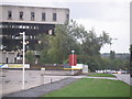
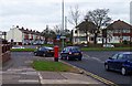
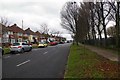
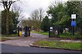
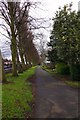
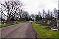
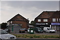
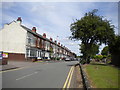
Photos of B26 1DU
Area Information
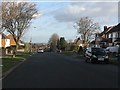
B26 1DU represents a small, tightly defined residential cluster on the outskirts of Birmingham, covering an area of just 4,945 square metres. The locality is home to 1,352 people, creating a relatively insulated community environment that feels distinct from the wider city sprawl. Situated approximately 3.5 miles from the Birmingham city centre, the postcode falls within the Council constituency of Yardley but operates as a specific geographic pocket suitable for those seeking a defined suburban setting. This area forms part of the historic South Yardley ward, which has evolved from its agrarian roots under Pershore Abbey into a modern residential district characterised by significant 20th-century development. You will find a neighbourhood where local planning constraints regarding flood risk, protected nature reserves, and woodlands are non-existent, allowing for straightforward housing development. While the land does not touch any outstanding natural beauty sites or Ramsar wetland areas, the proximity to key transport links like the Swan underpass and Coventry Road defines its accessibility. Living in B26 1DU means residing at the edge of established residential zones, bridging the gap between the quieter outskirts and the industrial or commercial heart of the greater Yardley area. The small footprint of this specific postcode suggests a neighbourhood suitable for buyers with specific street preferences rather than those seeking broad district characteristics.
- Area Type
- Postcode
- Area Size
- 4945 m²
- Population
- 1352
- Population Density
- 7009 people/km²
You are looking at a market characterised by stability due to the fact that 80 per cent of residents are homeowners. The overwhelming majority of properties in B26 1DU are houses, meaning you will not encounter any apartment blocks or flats in this specific postcode. This exclusivity in property type means the local housing stock consists of detached, semi-detached, or terraced homes rather than high-density developments. Because almost the entire population owns their accommodation, the rental sector is virtually non-existent within these boundaries. The small size of the area, covering only 4,945 square metres, limits the volume of active listings at any given time. Potential buyers should view this as a boutique market where properties come onto the market infrequently. The absence of social housing or rental properties suggests that the supply chain relies entirely on individual transactions. When evaluating homes in B26 1DU, you are assessing single-family residences where the¾ of the population purchase their homes outright. This creates a market driven by selling owners rather than landlords, which often stabilises prices and reduces the volatility typical of mixed-tenure areas.
House Prices in B26 1DU
Showing 6 properties
| Address | Type | Beds | Baths | Last Sale Price | Last Sale Date | |
|---|---|---|---|---|---|---|
| 3 Clay Lane, Birmingham, B26 1DU | house | - | - | £210,000 | Feb 2010 | |
| 1A Clay Lane, Birmingham, B26 1DU | Flat | - | - | £100,000 | Jan 2007 | |
| 5 Clay Lane, Birmingham, B26 1DU | Terraced | - | - | - | - | |
| 7 Clay Lane, Birmingham, B26 1DU | Terraced | - | - | - | - | |
| Flat 2, 1 Clay Lane, Birmingham, B26 1DU | Flat | - | - | - | - | |
| Flat 1, 1 Clay Lane, Birmingham, B26 1DU | Flat | - | - | - | - |
Energy Efficiency in B26 1DU
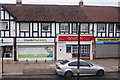
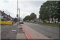
Your daily life in B26 1DU is dictated by immediate access to a range of practical amenities within walking or driving distance. There are five retail units situated nearby, providing food shopping and essentials at Tesco Yardley, Farmfoods Yardley, and Iceland Yardley. For travel, you have access to five railway stations, including Acocks Green Railway Station and Tyseley Railway Station, allowing easy commutes to broader parts of the city. Add to this five major metro destinations, ranging from Birmingham International Airport to the high street at Corporation Street, and you have a network that serves both work and leisure needs. The area itself is a small residential ward encompassing 1,352 residents across just 4,945 square metres. While there are no designated parks, protected woodlands, or nature reserves directly inside the boundary, the location sits near the historical trajectory of South Yardley and the broader Yardley district. The local history includes significant transport changes, such as the Swan underpass completed in 1967 and the widening of Coventry Road into a major highway in 1985. These infrastructures define the current road network you will navigate. Living in this postcode means prioritising convenience and proximity to established retail and transport clusters over local green space.
Amenities
Schools
| Rank | School | Type | Entry gender | Ages |
|---|
Explore more schools in this area
Go to Schools tabDemographics
The community within B26 1DU is defined by a mature population, with a median age of 47 years. The demographic profile is dominated by adults aged between 30 and 64 years, suggesting a neighbourhood with long-term residents rather than transient populations. A sobering fact regarding safety is the crime risk level, which sits at a warning threshold of 63 out of 100. This indicates medium crime rates that align with the broader average, meaning standard security precautions remain a necessary part of daily life for homeowners here. Ownership stability is a hallmark of this area, where 80 per cent of households own their homes. This high ownership rate contrasts sharply with the rental markets found elsewhere, reflecting a community invested in the local landscape. The accommodation type is exclusively houses, removing the option of living in any block of flats or apartments. Furthermore, the ethnic composition is predominantly White, indicating a established, homogenous community structure. These figures paint a picture of a settled demographic where residents have likely lived in their properties for extended periods, contributing to a neighbourhood that values privacy and established boundaries over high-density living.
Household Size
Accommodation Type
Tenure
Ethnic Group
Religion
Household Composition
Age
Household Deprivation
NS-SEC
Explore more demographic insights in this area
Go to Demographics tabPlanning
Planning Constraints
- Flood RiskPremium
- Ramsar Wetland SitesPremium
- Area of Outstanding Natural BeautyPremium
- Protected Nature ReservePremium
- Protected WoodlandPremium