Area Overview for B26 1BY
Photos of B26 1BY
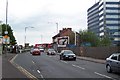
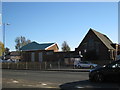
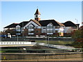
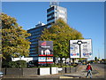


79 photos from this area
Area Information
Key information about the B26 1BY including its size, population, and administrative classification.
- Area Type
- Postcode
- Area Size
- 9361 m²
- Population
- 1597
- Population Density
- 3526 people/km²
House Prices in B26 1BY
41
Properties
£146,938
Average Sold Price
£27,000
Lowest Price
£230,000
Highest Price
Showing 41 properties
| Address | Type | Beds | Baths | Last Sale Price | Last Sale Date | |
|---|---|---|---|---|---|---|
| 48 Emily Road, Birmingham, B26 1BY | Terraced | 3 | 1 | £225,000 | Sep 2025 | |
| 14 Emily Road, Birmingham, B26 1BY | Terraced | 3 | 1 | £185,000 | Mar 2025 | |
| 58 Emily Road, Birmingham, B26 1BY | Terraced | 3 | 1 | £230,000 | Sep 2024 | |
| 11 Emily Road, Birmingham, B26 1BY | Terraced | 3 | 1 | £220,000 | Aug 2024 | |
| 64 Emily Road, Birmingham, B26 1BY | Retail | 5 | 2 | £210,000 | Jun 2024 | |
| 50 Emily Road, Birmingham, B26 1BY | house | - | - | £200,000 | Dec 2023 | |
| 28 Emily Road, Birmingham, B26 1BY | Terraced | 2 | - | £190,000 | Dec 2023 | |
| 17 Emily Road, Birmingham, B26 1BY | Terraced | 2 | 1 | £220,000 | Nov 2023 | |
| 26 Emily Road, Birmingham, B26 1BY | house | - | - | £190,000 | Jan 2023 | |
| 38 Emily Road, Birmingham, B26 1BY | Terraced | 2 | 1 | £167,000 | Oct 2021 |
Page 1 of 5
Energy Efficiency in B26 1BY
Amenities
Schools
| Rank | School | Type | Entry gender | Ages |
|---|
Explore more schools in this area
Go to Schools tabDemographics
Household Size
One person
most common
Accommodation Type
Houses
most common
Tenure
47
majority
Ethnic Group
White
most common
Religion
N/A
most common
Household Composition
N/A
most common
Age
47
median
Adults (30-64 years)
most common
Household Deprivation
N/A
with no deprivation
NS-SEC
22
in Lower managerial occupations
Explore more demographic insights in this area
Go to Demographics tabPlanning
Planning Constraints
- Flood RiskPremium
- Ramsar Wetland SitesPremium
- Area of Outstanding Natural BeautyPremium
- Protected Nature ReservePremium
- Protected WoodlandPremium