Area Overview for B25 8NF
Photos of B25 8NF
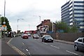
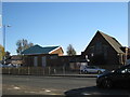
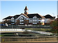
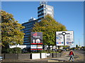


79 photos from this area
Area Information
Key information about the B25 8NF including its size, population, and administrative classification.
- Area Type
- Postcode
- Area Size
- 1.5 hectares
- Population
- 1597
- Population Density
- 3526 people/km²
House Prices in B25 8NF
18
Properties
£131,444
Average Sold Price
£49,000
Lowest Price
£292,000
Highest Price
Showing 18 properties
| Address | Type | Beds | Baths | Last Sale Price | Last Sale Date | |
|---|---|---|---|---|---|---|
| 20 Martin Close, Birmingham, B25 8NF | Detached | 2 | 1 | £182,000 | Sep 2025 | |
| 7 Martin Close, Birmingham, B25 8NF | Terraced | 2 | 1 | £175,000 | Oct 2023 | |
| 8 Martin Close, Birmingham, B25 8NF | Semi-detached | 2 | 1 | £172,000 | Jan 2022 | |
| 16 Martin Close, Birmingham, B25 8NF | Semi-detached | 3 | 2 | £292,000 | Jan 2022 | |
| 18 Martin Close, Birmingham, B25 8NF | Semi-detached | 3 | - | £225,000 | Sep 2021 | |
| 17 Martin Close, Birmingham, B25 8NF | Semi-detached | 2 | 1 | £152,000 | Mar 2019 | |
| 9 Martin Close, Birmingham, B25 8NF | Semi-detached | 2 | 1 | £120,000 | Sep 2013 | |
| 11 Martin Close, Birmingham, B25 8NF | house | - | - | £124,999 | Oct 2012 | |
| 15 Martin Close, Birmingham, B25 8NF | house | 2 | - | £110,000 | Nov 2011 | |
| 12 Martin Close, Birmingham, B25 8NF | house | 2 | 1 | £127,000 | Jan 2007 |
Page 1 of 2
Energy Efficiency in B25 8NF
Amenities
Schools
| Rank | School | Type | Entry gender | Ages |
|---|
Explore more schools in this area
Go to Schools tabDemographics
Household Size
One person
most common
Accommodation Type
Houses
most common
Tenure
47
majority
Ethnic Group
White
most common
Religion
N/A
most common
Household Composition
N/A
most common
Age
47
median
Adults (30-64 years)
most common
Household Deprivation
N/A
with no deprivation
NS-SEC
22
in Lower managerial occupations
Explore more demographic insights in this area
Go to Demographics tabPlanning
Planning Constraints
- Flood RiskPremium
- Ramsar Wetland SitesPremium
- Area of Outstanding Natural BeautyPremium
- Protected Nature ReservePremium
- Protected WoodlandPremium