Area Overview for B25 8XE
Photos of B25 8XE
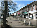
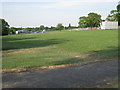
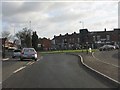
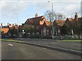
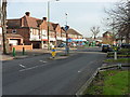
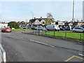
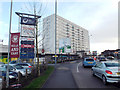
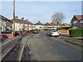
13 photos from this area
Area Information
Key information about the B25 8XE including its size, population, and administrative classification.
- Area Type
- Postcode
- Area Size
- 7453 m²
- Population
- 1597
- Population Density
- 3526 people/km²
House Prices in B25 8XE
33
Properties
£130,101
Average Sold Price
£18,000
Lowest Price
£205,000
Highest Price
Showing 33 properties
| Address | Type | Beds | Baths | Last Sale Price | Last Sale Date | |
|---|---|---|---|---|---|---|
| 62 Church Road, South Yardley, Birmingham, B25 8XE | Terraced | 3 | 1 | £205,000 | Jun 2024 | |
| 56 Church Road, South Yardley, Birmingham, B25 8XE | Retail | 3 | 2 | £205,000 | Jun 2022 | |
| 64 Church Road, South Yardley, Birmingham, B25 8XE | house | 3 | - | £185,000 | Aug 2021 | |
| 78 Church Road, South Yardley, Birmingham, B25 8XE | Terraced | 3 | 1 | £159,000 | Feb 2021 | |
| 46 Church Road, South Yardley, Birmingham, B25 8XE | Terraced | 3 | - | £150,000 | Dec 2019 | |
| 40 Church Road, South Yardley, Birmingham, B25 8XE | Terraced | 3 | 2 | £148,000 | Dec 2018 | |
| 52 Church Road, South Yardley, Birmingham, B25 8XE | Terraced | 3 | 1 | £113,112 | Aug 2018 | |
| 34 Church Road, South Yardley, Birmingham, B25 8XE | Terraced | 1 | 1 | £118,000 | Apr 2018 | |
| 32 Church Road, South Yardley, Birmingham, B25 8XE | house | - | - | £135,000 | Sep 2017 | |
| 30 Church Road, South Yardley, Birmingham, B25 8XE | Terraced | 3 | 1 | £198,000 | Sep 2017 |
Page 1 of 4
Energy Efficiency in B25 8XE
Amenities
Schools
| Rank | School | Type | Entry gender | Ages |
|---|
Explore more schools in this area
Go to Schools tabDemographics
Household Size
One person
most common
Accommodation Type
Houses
most common
Tenure
47
majority
Ethnic Group
White
most common
Religion
N/A
most common
Household Composition
N/A
most common
Age
47
median
Adults (30-64 years)
most common
Household Deprivation
N/A
with no deprivation
NS-SEC
22
in Lower managerial occupations
Explore more demographic insights in this area
Go to Demographics tabPlanning
Planning Constraints
- Flood RiskPremium
- Ramsar Wetland SitesPremium
- Area of Outstanding Natural BeautyPremium
- Protected Nature ReservePremium
- Protected WoodlandPremium