Area Overview for B25 8QS
Photos of B25 8QS


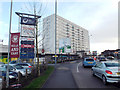
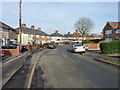
13 photos from this area
Area Information
Key information about the B25 8QS including its size, population, and administrative classification.
- Area Type
- Postcode
- Area Size
- 1.3 hectares
- Population
- 1789
- Population Density
- 8976 people/km²
House Prices in B25 8QS
43
Properties
£121,256
Average Sold Price
£47,500
Lowest Price
£225,000
Highest Price
Showing 43 properties
| Address | Type | Beds | Baths | Last Sale Price | Last Sale Date | |
|---|---|---|---|---|---|---|
| 199 Millhouse Road, Birmingham, B25 8QS | Semi-detached | 3 | 1 | £146,000 | Sep 2024 | |
| 139 Millhouse Road, Birmingham, B25 8QS | Terraced | 3 | 1 | £185,000 | Sep 2022 | |
| 149 Millhouse Road, Birmingham, B25 8QS | house | - | - | £177,000 | Jan 2022 | |
| 183 Millhouse Road, Birmingham, B25 8QS | house | - | - | £100,000 | Mar 2021 | |
| 147 Millhouse Road, Birmingham, B25 8QS | Terraced | 3 | 1 | £165,000 | Feb 2021 | |
| 203 Millhouse Road, Birmingham, B25 8QS | Terraced | 3 | 1 | £159,000 | Aug 2019 | |
| 143 Millhouse Road, Birmingham, B25 8QS | Semi-detached | 3 | 1 | £105,000 | Oct 2018 | |
| 133 Millhouse Road, Birmingham, B25 8QS | house | - | - | £225,000 | Jun 2016 | |
| 161 Millhouse Road, Birmingham, B25 8QS | house | - | - | £126,000 | Nov 2015 | |
| 215 Millhouse Road, Birmingham, B25 8QS | house | 2 | 1 | £91,250 | Aug 2015 |
Page 1 of 5
Energy Efficiency in B25 8QS
Amenities
Schools
| Rank | School | Type | Entry gender | Ages |
|---|
Explore more schools in this area
Go to Schools tabDemographics
Household Size
Family (3-5 people)
most common
Accommodation Type
Houses
most common
Tenure
47
majority
Ethnic Group
asian_total
most common
Religion
N/A
most common
Household Composition
N/A
most common
Age
47
median
Adults (30-64 years)
most common
Household Deprivation
N/A
with no deprivation
NS-SEC
14
in Lower managerial occupations
Explore more demographic insights in this area
Go to Demographics tabPlanning
Planning Constraints
- Flood RiskPremium
- Ramsar Wetland SitesPremium
- Area of Outstanding Natural BeautyPremium
- Protected Nature ReservePremium
- Protected WoodlandPremium