Area Overview for B23 6SZ
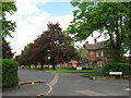
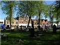
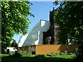
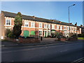
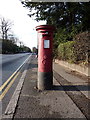
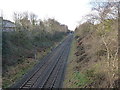
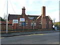
Photos of B23 6SZ

Area Information
B23 6SZ is a small, densely populated residential cluster within the Erdington area of Birmingham, England. Covering just 487 square metres, the postcode is home to 1,820 people, resulting in a population density of over 3.7 million per square kilometre — an unusual concentration for such a compact area. Historically, Erdington was a village near the River Tame, evolving into a suburban district of Birmingham with a core shopping district at Erdington High Street. Today, the area retains a mix of older residential stock and modern developments, with a focus on local amenities. Daily life here is shaped by proximity to retail, transport hubs, and schools, though the high density means space is limited. The postcode’s compact size makes it a microcosm of suburban Birmingham, where residents navigate a balance between convenience and proximity to the city’s broader infrastructure. For those seeking a tight-knit community with accessible services, B23 6SZ offers a compact, functional living environment.
- Area Type
- Postcode
- Area Size
- 487 m²
- Population
- 1820
- Population Density
- 4444 people/km²
The property market in B23 6SZ is characterised by a low home ownership rate of 25%, suggesting that the majority of the area’s housing stock is rented out. The accommodation type is primarily houses, which, given the postcode’s small size and high density, likely refers to smaller terraced or semi-detached homes. This mix of rental properties and owner-occupied houses creates a dynamic but limited market, particularly in a small area like B23 6SZ. Buyers should consider that the scarcity of available properties may drive competition, especially for homes in good condition. The focus on houses rather than flats or apartments may appeal to those seeking traditional family homes, but the compact nature of the postcode means buyers must prioritise proximity to amenities and transport links. For those seeking investment opportunities, the rental market here could be viable, though the low ownership rate may reflect broader economic or demographic trends in the area.
House Prices in B23 6SZ
Showing 1 properties
| Address | Type | Beds | Baths | Last Sale Price | Last Sale Date | |
|---|---|---|---|---|---|---|
| Lloyds Bank, 207 High Street, Erdington, Birmingham, B23 6SZ | retail_financial | - | - | - | - |
Energy Efficiency in B23 6SZ
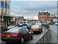
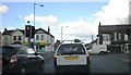
The lifestyle in B23 6SZ is defined by proximity to retail, transport, and green spaces. Within practical reach are shops like Iceland Erdington, Farmfoods Erdington, and Heron Erdington, offering everyday essentials. The area’s rail and metro stations, including Erdington Railway Station and Chester Road, provide easy access to Birmingham’s broader network. Parks and open spaces, such as Rookery Park (former district offices) and Brookvale Park Lake (a former reservoir), offer recreational opportunities. The historical presence of the River Tame and nearby canals, like the Birmingham Fazeley Canal, adds a scenic element to daily life. While the high density limits private green space, the area’s compact design ensures residents are never far from amenities. The mix of retail, transport, and parks creates a functional, if space-constrained, lifestyle suited to those prioritising convenience over expansive living areas.
Amenities
Schools
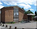
Residents of B23 6SZ have access to a range of educational institutions, including Osborne Nursery School, which provides early years education, and Osborne Primary School, rated ‘good’ by Ofsted. For independent schooling, Highclare School and Imedia School — the latter rated ‘outstanding’ — offer alternative options. The presence of both state and independent schools gives families flexibility in choosing educational paths. Osborne Primary School’s ‘good’ rating indicates a solid foundation in primary education, while Imedia’s ‘outstanding’ status suggests high-quality resources and outcomes. The diversity of school types reflects Erdington’s role as a suburban hub with varied educational provision. Families seeking a mix of affordability and academic excellence may find the area’s schools particularly appealing, though the proximity of these institutions to B23 6SZ should be verified for exact catchment areas.
| Rank | School | Type | Entry gender | Ages |
|---|
Explore more schools in this area
Go to Schools tabDemographics
The population of B23 6SZ has a median age of 47, with the most common age range being adults aged 30–64. This suggests a community skewed towards middle-aged residents, likely with established careers and families. Only 25% of homes are owner-occupied, indicating a higher proportion of rental properties compared to owner-occupied dwellings. The predominant accommodation type is houses, though the small area size and high population density imply these are likely terraced or semi-detached homes rather than larger detached properties. The predominant ethnic group is White, with no specific data on other demographics. The low home ownership rate may reflect economic pressures or a transient population, though it also suggests a rental market that could offer flexibility for buyers seeking short-term or investment properties. The age profile and housing stock point to a stable but not rapidly growing community, with a focus on practical, family-oriented living.
Household Size
Accommodation Type
Tenure
Ethnic Group
Religion
Household Composition
Age
Household Deprivation
NS-SEC
Explore more demographic insights in this area
Go to Demographics tabPlanning
Planning Constraints
- Flood RiskPremium
- Ramsar Wetland SitesPremium
- Area of Outstanding Natural BeautyPremium
- Protected Nature ReservePremium
- Protected WoodlandPremium