Area Overview for B23 6TA
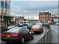
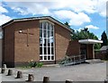
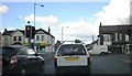
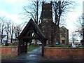
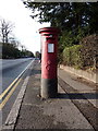
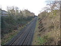
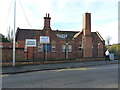
Photos of B23 6TA

Area Information
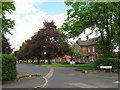
B23 6TA is a small residential postcode area in Birmingham, England, with a population of 1820, reflecting its compact nature. Nestled within the Erdington district, it lies near the River Tame and historic Chester Road, once a Roman route. The area’s character blends suburban tranquillity with proximity to Birmingham’s urban fabric. Residents benefit from a mix of historical and modern amenities, including Erdington High Street, a major retail hub, and nearby parks like Rookery Park. The median age of 47 suggests a stable, adult-oriented community, with many households likely centred around families or long-term residents. While small, the area connects to broader Birmingham networks via rail and metro links, offering access to the city’s cultural and economic opportunities. Its low flood risk and absence of environmental constraints make it a practical choice, though residents should be mindful of local crime statistics. This postcode is ideal for those seeking a settled lifestyle with easy access to urban resources.
- Area Type
- Postcode
- Area Size
- Not available
- Population
- 1820
- Population Density
- 4444 people/km²
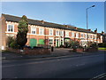
The property market in B23 6TA is characterised by a low home ownership rate of 25%, indicating that the area is primarily a rental market. The accommodation type is predominantly houses, which are more common than flats or apartments. This suggests a housing stock that favours larger, detached or semi-detached homes, potentially appealing to families or individuals seeking space. However, the limited home ownership percentage means that buyers may find fewer owner-occupied properties available, with more options in the rental sector. The small size of the postcode area also implies a constrained housing stock, so buyers may need to consider adjacent areas for broader choices. The focus on houses may contribute to a quieter, suburban feel, though the lower home ownership rate could affect the area’s long-term stability for property investment.
House Prices in B23 6TA
No properties found in this postcode.
Energy Efficiency in B23 6TA
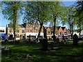
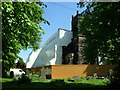
The lifestyle in B23 6TA is enhanced by a mix of practical amenities and historical character. Nearby retail options include Iceland Erdington, Farmfoods Erdington, and Heron Erdington, offering everyday shopping needs. Transport links are robust, with five rail stations and five metro stops providing easy access to Birmingham’s urban core. Parks and green spaces, such as Rookery Park, offer recreational opportunities, while the area’s historical roots, including Erdington High Street, add cultural depth. The presence of St Barnabas Church and Rookery Park reflects a blend of community and heritage. For leisure, the Birmingham Fazeley Canal and Brookvale Park Lake provide scenic spots. The area’s mix of modern convenience and historical significance creates a balanced lifestyle, ideal for those seeking both accessibility and a sense of place.
Amenities
Schools
B23 6TA is served by a range of schools, including Osborne Nursery School, which provides early education, and Osborne Primary School, rated ‘good’ by Ofsted. Highclare School and Imedia School offer independent education options, with Imedia holding an ‘outstanding’ rating. The presence of both state and independent schools offers families flexibility in choosing educational paths. The dual availability of primary and nursery education ensures continuity for young families. However, the absence of secondary schools in the immediate area may require commuting to nearby districts. The quality of schools, particularly Imedia’s ‘outstanding’ rating, suggests strong academic provision for those prioritising independent education. Families should consider proximity to secondary schools when evaluating long-term suitability for their needs.
| Rank | School | Type | Entry gender | Ages |
|---|
Explore more schools in this area
Go to Schools tabDemographics
The community in B23 6TA has a median age of 47, with the most common age group being adults aged 30–64. This indicates a mature population, likely with established careers and family ties. Home ownership is low at 25%, suggesting that a significant portion of the housing stock is rented. The predominant accommodation type is houses, which may reflect a preference for larger, more private living spaces. The predominant ethnic group is White, though no specific data on other demographics is provided. This profile suggests a community with a strong sense of continuity, where many residents have lived for years or decades. The lower home ownership rate may influence social dynamics, with a greater reliance on local services and community networks. For quality of life, the area’s stability and mature age profile could support a cohesive, low-turnover environment.
Household Size
Accommodation Type
Tenure
Ethnic Group
Religion
Household Composition
Age
Household Deprivation
NS-SEC
Explore more demographic insights in this area
Go to Demographics tabPlanning
Planning Constraints
- Flood RiskPremium
- Ramsar Wetland SitesPremium
- Area of Outstanding Natural BeautyPremium
- Protected Nature ReservePremium
- Protected WoodlandPremium