Area Overview for B21 9NQ
Photos of B21 9NQ

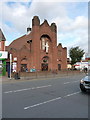
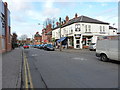
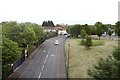
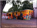
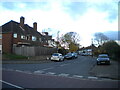
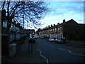

55 photos from this area
Area Information
Key information about the B21 9NQ including its size, population, and administrative classification.
- Area Type
- Postcode
- Area Size
- 1.2 hectares
- Population
- 1789
- Population Density
- 10643 people/km²
House Prices in B21 9NQ
62
Properties
£86,357
Average Sold Price
£17,750
Lowest Price
£182,000
Highest Price
Showing 62 properties
| Address | Type | Beds | Baths | Last Sale Price | Last Sale Date | |
|---|---|---|---|---|---|---|
| 148 Alfred Road, Lozells And East Handsworth, Birmingham, B21 9NQ | house | - | - | £157,500 | Nov 2022 | |
| 97 Alfred Road, Lozells And East Handsworth, Birmingham, B21 9NQ | house | - | - | £170,000 | Sep 2022 | |
| 112 Alfred Road, Lozells And East Handsworth, Birmingham, B21 9NQ | house | - | - | £72,450 | Mar 2022 | |
| 92 Alfred Road, Lozells And East Handsworth, Birmingham, B21 9NQ | Terraced | 4 | 1 | £182,000 | Dec 2021 | |
| 152 Alfred Road, Lozells And East Handsworth, Birmingham, B21 9NQ | house | - | - | £106,000 | Oct 2021 | |
| 100 Alfred Road, Lozells And East Handsworth, Birmingham, B21 9NQ | Terraced | 3 | 1 | £125,000 | May 2019 | |
| 172 Alfred Road, Lozells And East Handsworth, Birmingham, B21 9NQ | Terraced | 3 | 2 | £162,000 | Sep 2018 | |
| 88 Alfred Road, Lozells And East Handsworth, Birmingham, B21 9NQ | Terraced | 2 | 1 | £107,000 | Dec 2017 | |
| 168 Alfred Road, Lozells And East Handsworth, Birmingham, B21 9NQ | house | - | - | £110,000 | Jul 2017 | |
| 164 Alfred Road, Lozells And East Handsworth, Birmingham, B21 9NQ | Terraced | 3 | 1 | £114,500 | Nov 2016 |
Page 1 of 7
Energy Efficiency in B21 9NQ
Amenities
Schools
| Rank | School | Type | Entry gender | Ages |
|---|
Explore more schools in this area
Go to Schools tabDemographics
Household Size
Family (3-5 people)
most common
Accommodation Type
Houses
most common
Tenure
41
majority
Ethnic Group
asian_total
most common
Religion
N/A
most common
Household Composition
N/A
most common
Age
22
median
Adults (30-64 years)
most common
Household Deprivation
N/A
with no deprivation
NS-SEC
9
in Lower managerial occupations
Explore more demographic insights in this area
Go to Demographics tabPlanning
Planning Constraints
- Flood RiskPremium
- Ramsar Wetland SitesPremium
- Area of Outstanding Natural BeautyPremium
- Protected Nature ReservePremium
- Protected WoodlandPremium