Area Overview for B21 9NE
Photos of B21 9NE

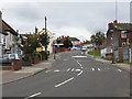
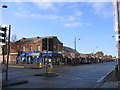
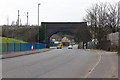
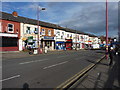

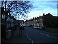

55 photos from this area
Area Information
Key information about the B21 9NE including its size, population, and administrative classification.
- Area Type
- Postcode
- Area Size
- 4050 m²
- Population
- 1789
- Population Density
- 10643 people/km²
House Prices in B21 9NE
20
Properties
£117,556
Average Sold Price
£26,000
Lowest Price
£200,000
Highest Price
Showing 20 properties
| Address | Type | Beds | Baths | Last Sale Price | Last Sale Date | |
|---|---|---|---|---|---|---|
| 16 Warstone Terrace, Birmingham, B21 9NE | house | 3 | 1 | £176,000 | Feb 2025 | |
| 11 Warstone Terrace, Birmingham, B21 9NE | Terraced | 4 | 2 | £200,000 | Oct 2024 | |
| 12 Warstone Terrace, Birmingham, B21 9NE | house | - | - | £170,000 | Jan 2023 | |
| 9 Warstone Terrace, Birmingham, B21 9NE | Terraced | 4 | 2 | £125,000 | Jul 2019 | |
| 18 Warstone Terrace, Birmingham, B21 9NE | Terraced | 3 | 1 | £105,000 | Mar 2015 | |
| 4 Warstone Terrace, Birmingham, B21 9NE | Terraced | 3 | - | £67,000 | Mar 2013 | |
| 8 Warstone Terrace, Birmingham, B21 9NE | house | - | - | £102,000 | Jun 2008 | |
| 17 Warstone Terrace, Birmingham, B21 9NE | house | - | - | £87,000 | Aug 2003 | |
| 10 Warstone Terrace, Birmingham, B21 9NE | Terraced | 3 | - | £26,000 | Dec 2001 | |
| 14 Warstone Terrace, Birmingham, B21 9NE | house | 3 | - | - | - |
Page 1 of 2
Energy Efficiency in B21 9NE
Amenities
Schools
| Rank | School | Type | Entry gender | Ages |
|---|
Explore more schools in this area
Go to Schools tabDemographics
Household Size
Family (3-5 people)
most common
Accommodation Type
Houses
most common
Tenure
41
majority
Ethnic Group
asian_total
most common
Religion
N/A
most common
Household Composition
N/A
most common
Age
22
median
Adults (30-64 years)
most common
Household Deprivation
N/A
with no deprivation
NS-SEC
9
in Lower managerial occupations
Explore more demographic insights in this area
Go to Demographics tabPlanning
Planning Constraints
- Flood RiskPremium
- Ramsar Wetland SitesPremium
- Area of Outstanding Natural BeautyPremium
- Protected Nature ReservePremium
- Protected WoodlandPremium