Area Overview for B21 8HP
Photos of B21 8HP

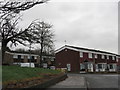
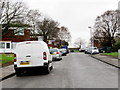
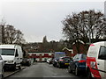
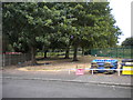
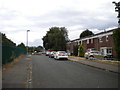
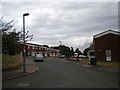
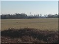
20 photos from this area
Area Information
Key information about the B21 8HP including its size, population, and administrative classification.
- Area Type
- Postcode
- Area Size
- 19.0 hectares
- Population
- 1394
- Population Density
- 1514 people/km²
House Prices in B21 8HP
36
Properties
£107,400
Average Sold Price
£30,000
Lowest Price
£186,000
Highest Price
Showing 36 properties
| Address | Type | Beds | Baths | Last Sale Price | Last Sale Date | |
|---|---|---|---|---|---|---|
| 47 Cradley Croft, Birmingham, B21 8HP | house | - | - | £140,000 | Jan 2025 | |
| 24 Cradley Croft, Birmingham, B21 8HP | Terraced | 3 | 2 | £186,000 | Apr 2023 | |
| 53 Cradley Croft, Birmingham, B21 8HP | Terraced | 3 | 1 | £80,000 | Mar 2022 | |
| 48 Cradley Croft, Birmingham, B21 8HP | Terraced | 3 | 1 | £147,000 | Sep 2020 | |
| 30 Cradley Croft, Birmingham, B21 8HP | Terraced | 3 | 1 | £102,000 | Oct 2015 | |
| 40 Cradley Croft, Birmingham, B21 8HP | Terraced | 3 | - | £98,000 | Aug 2014 | |
| 36 Cradley Croft, Birmingham, B21 8HP | Terraced | 3 | 1 | £110,000 | Feb 2008 | |
| 41 Cradley Croft, Birmingham, B21 8HP | Terraced | - | - | £114,000 | Nov 2007 | |
| 4 Cradley Croft, Birmingham, B21 8HP | Terraced | 4 | 1 | £125,000 | Jun 2007 | |
| 26 Cradley Croft, Birmingham, B21 8HP | house | - | - | £115,000 | Nov 2006 |
Page 1 of 4
Energy Efficiency in B21 8HP
Amenities
Schools
| Rank | School | Type | Entry gender | Ages |
|---|
Explore more schools in this area
Go to Schools tabDemographics
Household Size
Family (3-5 people)
most common
Accommodation Type
Houses
most common
Tenure
44
majority
Ethnic Group
asian_total
most common
Religion
N/A
most common
Household Composition
N/A
most common
Age
47
median
Adults (30-64 years)
most common
Household Deprivation
N/A
with no deprivation
NS-SEC
18
in Lower managerial occupations
Explore more demographic insights in this area
Go to Demographics tabPlanning
Planning Constraints
- Flood RiskPremium
- Ramsar Wetland SitesPremium
- Area of Outstanding Natural BeautyPremium
- Protected Nature ReservePremium
- Protected WoodlandPremium