Area Overview for B20 3ST
Photos of B20 3ST
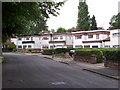

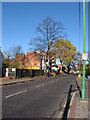
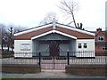
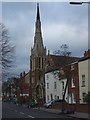
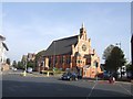
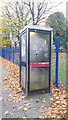
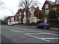
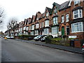

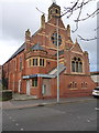
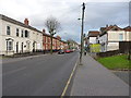
70 photos from this area
Area Information
Key information about the B20 3ST including its size, population, and administrative classification.
- Area Type
- Postcode
- Area Size
- 1.4 hectares
- Population
- 2048
- Population Density
- 8954 people/km²
House Prices in B20 3ST
19
Properties
£187,681
Average Sold Price
£61,000
Lowest Price
£505,000
Highest Price
Showing 19 properties
| Address | Type | Beds | Baths | Last Sale Price | Last Sale Date | |
|---|---|---|---|---|---|---|
| 9 West Drive, Lozells And East Handsworth, Birmingham, B20 3ST | Detached | 5 | 2 | £505,000 | May 2024 | |
| 5 West Drive, Lozells And East Handsworth, Birmingham, B20 3ST | Semi-detached | 4 | - | £217,500 | Nov 2015 | |
| 31 West Drive, Lozells And East Handsworth, Birmingham, B20 3ST | house | - | - | £269,950 | Sep 2010 | |
| 41 West Drive, Lozells And East Handsworth, Birmingham, B20 3ST | house | - | - | £315,000 | May 2005 | |
| 7 West Drive, Lozells And East Handsworth, Birmingham, B20 3ST | house | - | - | £220,000 | Jun 2004 | |
| 23 West Drive, Lozells And East Handsworth, Birmingham, B20 3ST | Detached | - | - | £122,000 | Oct 2001 | |
| 15 West Drive, Lozells And East Handsworth, Birmingham, B20 3ST | Detached | - | - | £181,775 | Sep 2001 | |
| 51 West Drive, Lozells And East Handsworth, Birmingham, B20 3ST | Detached | - | - | £120,000 | Nov 1999 | |
| 1 West Drive, Lozells And East Handsworth, Birmingham, B20 3ST | Semi-detached | 7 | 2 | £80,000 | Jul 1999 | |
| 39 West Drive, Lozells And East Handsworth, Birmingham, B20 3ST | Detached | - | - | £92,000 | Mar 1999 |
Page 1 of 2
Energy Efficiency in B20 3ST
Amenities
Schools
| Rank | School | Type | Entry gender | Ages |
|---|
Explore more schools in this area
Go to Schools tabDemographics
Household Size
One person
most common
Accommodation Type
Houses
most common
Tenure
32
majority
Ethnic Group
asian_total
most common
Religion
N/A
most common
Household Composition
N/A
most common
Age
47
median
Adults (30-64 years)
most common
Household Deprivation
N/A
with no deprivation
NS-SEC
13
in Lower managerial occupations
Explore more demographic insights in this area
Go to Demographics tabPlanning
Planning Constraints
- Flood RiskPremium
- Ramsar Wetland SitesPremium
- Area of Outstanding Natural BeautyPremium
- Protected Nature ReservePremium
- Protected WoodlandPremium