Area Overview for B20 1JS
Photos of B20 1JS
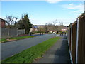
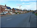
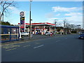
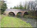
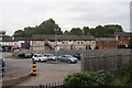
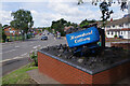
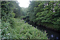
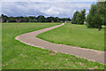
28 photos from this area
Area Information
Key information about the B20 1JS including its size, population, and administrative classification.
- Area Type
- Postcode
- Area Size
- 1.3 hectares
- Population
- 1583
- Population Density
- 941 people/km²
House Prices in B20 1JS
30
Properties
£235,353
Average Sold Price
£85,500
Lowest Price
£460,000
Highest Price
Showing 30 properties
| Address | Type | Beds | Baths | Last Sale Price | Last Sale Date | |
|---|---|---|---|---|---|---|
| 54 Underwood Road, Birmingham, B20 1JS | house | 4 | - | £460,000 | Jan 2022 | |
| 62 Underwood Road, Birmingham, B20 1JS | house | - | - | £355,000 | Nov 2021 | |
| 74 Underwood Road, Birmingham, B20 1JS | Terraced | - | - | £370,000 | Sep 2021 | |
| 60 Underwood Road, Birmingham, B20 1JS | Detached | 3 | 1 | £300,000 | Aug 2020 | |
| 52 Underwood Road, Birmingham, B20 1JS | house | - | - | £317,000 | Jun 2020 | |
| 36 Underwood Road, Birmingham, B20 1JS | Detached | 4 | 1 | £325,000 | Sep 2018 | |
| 32 Underwood Road, Birmingham, B20 1JS | Detached | 4 | 1 | £240,000 | Jun 2017 | |
| 48 Underwood Road, Birmingham, B20 1JS | Detached | 4 | - | £260,000 | May 2015 | |
| 80 Underwood Road, Birmingham, B20 1JS | Detached | 4 | - | £195,000 | Nov 2014 | |
| 26 Underwood Road, Birmingham, B20 1JS | house | - | - | £205,000 | Mar 2009 |
Page 1 of 3
Energy Efficiency in B20 1JS
Amenities
Schools
| Rank | School | Type | Entry gender | Ages |
|---|
Explore more schools in this area
Go to Schools tabDemographics
Household Size
Family (3-5 people)
most common
Accommodation Type
Houses
most common
Tenure
88
majority
Ethnic Group
asian_total
most common
Religion
N/A
most common
Household Composition
N/A
most common
Age
47
median
Adults (30-64 years)
most common
Household Deprivation
N/A
with no deprivation
NS-SEC
30
in Lower managerial occupations
Explore more demographic insights in this area
Go to Demographics tabPlanning
Planning Constraints
- Flood RiskPremium
- Ramsar Wetland SitesPremium
- Area of Outstanding Natural BeautyPremium
- Protected Nature ReservePremium
- Protected WoodlandPremium