Area Overview for B20 1ED
Photos of B20 1ED
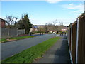
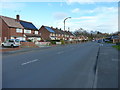
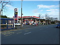
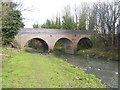
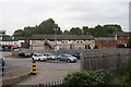
28 photos from this area
Area Information
Key information about the B20 1ED including its size, population, and administrative classification.
- Area Type
- Postcode
- Area Size
- 1.0 hectares
- Population
- 1592
- Population Density
- 5136 people/km²
House Prices in B20 1ED
28
Properties
£163,845
Average Sold Price
£50,000
Lowest Price
£260,000
Highest Price
Showing 28 properties
| Address | Type | Beds | Baths | Last Sale Price | Last Sale Date | |
|---|---|---|---|---|---|---|
| 73 Millfield Road, Birmingham, B20 1ED | house | - | - | £260,000 | Nov 2021 | |
| 75 Millfield Road, Birmingham, B20 1ED | house | - | - | £260,000 | Oct 2021 | |
| 111 Millfield Road, Birmingham, B20 1ED | Semi-detached | 3 | 1 | £220,000 | Sep 2021 | |
| 87 Millfield Road, Birmingham, B20 1ED | Terraced | - | - | £170,000 | May 2021 | |
| 97 Millfield Road, Birmingham, B20 1ED | house | - | - | £110,000 | Dec 2019 | |
| 115 Millfield Road, Birmingham, B20 1ED | house | - | - | £193,500 | Jul 2018 | |
| 103 Millfield Road, Birmingham, B20 1ED | Semi-detached | 3 | - | £185,000 | Jul 2018 | |
| 107 Millfield Road, Birmingham, B20 1ED | Semi-detached | 4 | 3 | £217,000 | Mar 2017 | |
| 63 Millfield Road, Birmingham, B20 1ED | Semi-detached | 3 | 1 | £175,000 | Nov 2016 | |
| 65 Millfield Road, Birmingham, B20 1ED | Semi-detached | 3 | 1 | £174,000 | Jan 2016 |
Page 1 of 3
Energy Efficiency in B20 1ED
Amenities
Schools
| Rank | School | Type | Entry gender | Ages |
|---|
Explore more schools in this area
Go to Schools tabDemographics
Household Size
Family (3-5 people)
most common
Accommodation Type
Houses
most common
Tenure
84
majority
Ethnic Group
asian_total
most common
Religion
N/A
most common
Household Composition
N/A
most common
Age
47
median
Adults (30-64 years)
most common
Household Deprivation
N/A
with no deprivation
NS-SEC
31
in Lower managerial occupations
Explore more demographic insights in this area
Go to Demographics tabPlanning
Planning Constraints
- Flood RiskPremium
- Ramsar Wetland SitesPremium
- Area of Outstanding Natural BeautyPremium
- Protected Nature ReservePremium
- Protected WoodlandPremium