Area Overview for B18 7LE
Photos of B18 7LE
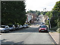
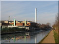
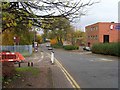
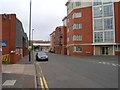
100 photos from this area
Area Information
Key information about the B18 7LE including its size, population, and administrative classification.
- Area Type
- Postcode
- Area Size
- 1.2 hectares
- Population
- 1581
- Population Density
- 4240 people/km²
House Prices in B18 7LE
32
Properties
£124,062
Average Sold Price
£36,000
Lowest Price
£190,000
Highest Price
Showing 32 properties
| Address | Type | Beds | Baths | Last Sale Price | Last Sale Date | |
|---|---|---|---|---|---|---|
| 61 Ellen Street, Birmingham, B18 7LE | house | 3 | 1 | £190,000 | Jul 2024 | |
| 71 Ellen Street, Birmingham, B18 7LE | Terraced | 3 | 2 | £180,000 | Mar 2024 | |
| 73 Ellen Street, Birmingham, B18 7LE | house | 3 | 1 | £175,000 | Nov 2023 | |
| 98 Ellen Street, Birmingham, B18 7LE | Terraced | 3 | 1 | £175,000 | Oct 2019 | |
| 64 Ellen Street, Birmingham, B18 7LE | house | - | - | £70,800 | Mar 2019 | |
| 81 Ellen Street, Birmingham, B18 7LE | Terraced | 3 | 2 | £161,000 | Jul 2018 | |
| 60 Ellen Street, Birmingham, B18 7LE | Terraced | 3 | 1 | £136,000 | Sep 2016 | |
| 79 Ellen Street, Birmingham, B18 7LE | Terraced | 3 | 1 | £128,000 | Jun 2016 | |
| 72 Ellen Street, Birmingham, B18 7LE | Terraced | 2 | 1 | £108,000 | Jun 2015 | |
| 74 Ellen Street, Birmingham, B18 7LE | Terraced | 2 | - | £109,000 | Nov 2013 |
Page 1 of 4
Energy Efficiency in B18 7LE
Amenities
Schools
| Rank | School | Type | Entry gender | Ages |
|---|
Explore more schools in this area
Go to Schools tabDemographics
Household Size
Family (3-5 people)
most common
Accommodation Type
Houses
most common
Tenure
29
majority
Ethnic Group
black_total
most common
Religion
N/A
most common
Household Composition
N/A
most common
Age
47
median
Adults (30-64 years)
most common
Household Deprivation
N/A
with no deprivation
NS-SEC
15
in Lower managerial occupations
Explore more demographic insights in this area
Go to Demographics tabPlanning
Planning Constraints
- Flood RiskPremium
- Ramsar Wetland SitesPremium
- Area of Outstanding Natural BeautyPremium
- Protected Nature ReservePremium
- Protected WoodlandPremium