Area Overview for B16 9NZ
Photos of B16 9NZ


Area Information
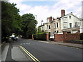
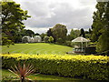
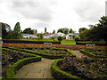
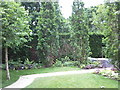
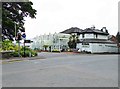
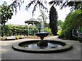
Living in B16 9NZ means inhabiting a compact, densely populated postcode area within the broader Edgbaston district of Birmingham. With a population of 1,881 spread over 6,446 square metres, the area is characterised by its suburban feel, historic private houses, and green spaces. Edgbaston itself has long been a draw for affluent residents, with its tree-lined streets and proximity to cultural landmarks. The area’s demographic profile suggests a mature community, with a median age of 47 and a majority of residents aged 30–64. This reflects a stable, established population, many of whom own their homes—82% of properties are owner-occupied. The area’s small size means it is tightly integrated with nearby amenities, from retail hubs to transport links, offering a blend of convenience and quiet residential charm. Its historical roots, including ties to figures like J.R.R. Tolkien and Cardinal Newman, add layers of cultural significance. For buyers, B16 9NZ presents a niche opportunity to enter a tightly knit, well-serviced community with a distinct character shaped by its past and present.
- Area Type
- Postcode
- Area Size
- 6446 m²
- Population
- Not available
- Population Density
- Not available
The property market in B16 9NZ is defined by high home ownership (82%) and a focus on houses, which suggests a predominantly owner-occupied area with limited rental activity. This indicates a community where long-term residency is the norm, and properties are likely to be family homes rather than investment assets. The small size of the postcode area means the housing stock is limited, with few new developments to expand the market. Buyers should consider that the area’s appeal lies in its established character, historic architecture, and proximity to amenities, rather than in speculative growth. The predominance of houses may also mean that properties are larger and more suited to families, though the compact nature of the postcode means that buyers must look to surrounding areas for additional options. For those seeking a stable, low-maintenance investment, B16 9NZ offers a niche opportunity, but its limited size means competition for available properties could be intense.
House Prices in B16 9NZ
No properties found in this postcode.
Energy Efficiency in B16 9NZ
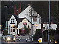
Life in B16 9NZ is enriched by its proximity to a range of amenities, from retail hubs to cultural and recreational spaces. The area’s retail offerings include major supermarkets such as Tesco Hagley, Spar Ample, and Morrisons Edgbaston, ensuring everyday shopping needs are met. Nearby metro areas like Edgbaston Village, Centenary Square, and Town Hall provide access to dining, entertainment, and public services. Rail stations such as Five Ways, University, and Jewellery Quarter connect residents to wider Birmingham, facilitating both daily commutes and weekend excursions. The area’s suburban character is complemented by its historical and cultural landmarks, including Grade I listed buildings and former sites like the BBC Pebble Mill Studios. This blend of convenience, heritage, and connectivity offers a lifestyle that balances urban accessibility with the tranquillity of a residential neighbourhood.
Amenities
Schools
| Rank | School | Type | Entry gender | Ages |
|---|
Explore more schools in this area
Go to Schools tabDemographics
The community in B16 9NZ is predominantly composed of adults aged 30–64, with a median age of 47. This suggests a mature, settled population, many of whom are likely to be in their peak earning years or retired. Home ownership is high, with 82% of residents owning their homes, indicating a stable, long-term presence in the area. The accommodation type is primarily houses, reflecting a residential character that contrasts with high-density urban living. The predominant ethnic group is the Asian_total category, which shapes the cultural and social dynamics of the area. While specific deprivation data is not provided, the high home ownership rate and moderate population density suggest a community with relatively strong economic foundations. However, the absence of detailed socio-economic indicators means that broader quality-of-life factors, such as access to services or employment opportunities, remain less defined. The area’s demographic profile aligns with its suburban, affluent image, where historic homes and established neighbourhoods dominate.
Household Size
Accommodation Type
Tenure
Ethnic Group
Religion
Household Composition
Age
Household Deprivation
NS-SEC
Explore more demographic insights in this area
Go to Demographics tabPlanning
Planning Constraints
- Flood RiskPremium
- Ramsar Wetland SitesPremium
- Area of Outstanding Natural BeautyPremium
- Protected Nature ReservePremium
- Protected WoodlandPremium