Area Overview for B16 9HW
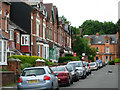
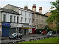
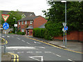
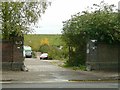
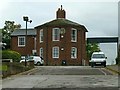
Photos of B16 9HW


Area Information
B16 9HW is a small, defined postcode area within the broader Edgbaston district of Birmingham, known for its suburban character and historic residential appeal. With a population of just 2077, it reflects the compact nature of the area, which has long been associated with affluent living. Edgbaston itself, historically part of Warwickshire, retains a mix of tree-lined streets, private homes, and green spaces that have drawn wealthy residents since the 19th century. The area’s proximity to Birmingham’s city centre, coupled with its quieter, residential vibe, makes it a niche choice for those seeking a balance between urban accessibility and suburban tranquillity. Daily life here is shaped by its proximity to key landmarks such as Edgbaston Hall and the Birmingham Oratory, alongside practical amenities like nearby rail and metro links. The postcode’s small size means it is tightly integrated with surrounding wards like Harborne and Quinton, creating a cohesive, community-focused environment. For buyers, B16 9HW offers a snapshot of Edgbaston’s legacy as a place where historic architecture meets modern living needs.
- Area Type
- Postcode
- Area Size
- Not available
- Population
- 2077
- Population Density
- 5483 people/km²
The property market in B16 9HW is characterised by a 29% home ownership rate, which is significantly lower than the national average, indicating that the area is more rental-focused than owner-occupied. The predominant accommodation type is flats, reflecting a housing stock that is likely to be older and more densely populated. This suggests that the area may appeal to professionals or families seeking manageable, centrally located housing rather than larger homes. The limited home ownership rate could also mean that property values are influenced by rental demand, potentially offering opportunities for investors. However, the small size of the postcode means that the housing market is tightly integrated with adjacent areas like Edgbaston and Harborne, where similar characteristics prevail. For buyers, this presents a challenge: the limited number of owner-occupied properties may reduce competition but also restrict options. The focus on flats may appeal to those prioritising convenience over space, though it could limit long-term equity growth compared to larger properties.
House Prices in B16 9HW
No properties found in this postcode.
Energy Efficiency in B16 9HW
The lifestyle in B16 9HW is shaped by its proximity to a range of practical amenities. Retail options include Tesco Hagley, Spar Ample, and Tesco Edgbaston, offering everyday shopping needs within easy reach. The area’s metro and rail links connect residents to vibrant locations like Edgbaston Village, Centenary Square, and the Town Hall, which host cultural and commercial activity. These connections mean that residents can access dining, leisure, and social opportunities without needing to travel far. The presence of multiple railway stations also facilitates travel to surrounding areas, enhancing the area’s appeal for those who value convenience. While B16 9HW itself is a small postcode, its integration with nearby wards ensures a variety of experiences within a short distance. The mix of retail, transport, and urban connectivity contributes to a lifestyle that balances suburban comfort with urban accessibility.
Amenities
Schools
The nearest school to B16 9HW is St Paul’s School for Girls, a primary school with an outstanding Ofsted rating. This single primary school suggests a limited range of educational options for families, though its high rating indicates quality teaching and facilities. The absence of secondary schools in the immediate vicinity means that students would need to travel to nearby areas for secondary education, which is common in smaller postcode clusters. For families prioritising primary education, St Paul’s offers a strong foundation, but the lack of a broader school network may require careful planning for secondary schooling. The school’s presence also aligns with Edgbaston’s historical appeal to families, reinforcing the area’s reputation as a place where education is a key consideration for residents.
| Rank | School | Type | Entry gender | Ages |
|---|---|---|---|---|
| 1 | St Paul's School for Girls | primary | N/A | N/A |
Explore more schools in this area
Go to Schools tabDemographics
The population of B16 9HW is predominantly adults aged 30–64, with a median age of 47, reflecting a mature, settled community. Home ownership here is relatively low at 29%, indicating a rental market that dominates the area. The accommodation type is largely flats, which aligns with the suburban yet compact nature of the postcode. The predominant ethnic group is White, though no specific diversity statistics are provided. This demographic profile suggests a community that is stable but not rapidly changing, with residents likely established in their careers and family lives. The low home ownership rate may imply a reliance on rental properties, which could affect long-term investment potential. However, the presence of a primary school with an outstanding Ofsted rating suggests a focus on family-friendly amenities, even if the housing stock is more transient. The area’s age profile also indicates a population that may have higher disposable income, given Edgbaston’s historical association with affluent residents.
Household Size
Accommodation Type
Tenure
Ethnic Group
Religion
Household Composition
Age
Household Deprivation
NS-SEC
Explore more demographic insights in this area
Go to Demographics tabPlanning
Planning Constraints
- Flood RiskPremium
- Ramsar Wetland SitesPremium
- Area of Outstanding Natural BeautyPremium
- Protected Nature ReservePremium
- Protected WoodlandPremium
- Crime RiskPremium