Area Overview for B16 0SX
Photos of B16 0SX

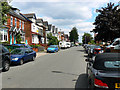
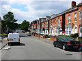

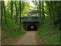

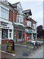
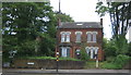
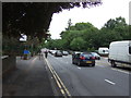
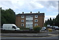
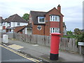

60 photos from this area
Area Information
Key information about the B16 0SX including its size, population, and administrative classification.
- Area Type
- Postcode
- Area Size
- 2.6 hectares
- Population
- 1968
- Population Density
- 5595 people/km²
House Prices in B16 0SX
49
Properties
£198,714
Average Sold Price
£67,000
Lowest Price
£465,000
Highest Price
Showing 49 properties
| Address | Type | Beds | Baths | Last Sale Price | Last Sale Date | |
|---|---|---|---|---|---|---|
| 102 Stanmore Road, Soho, Birmingham, B16 0SX | Detached | 3 | 2 | £425,000 | Mar 2025 | |
| 121 Stanmore Road, Soho, Birmingham, B16 0SX | Detached | 4 | 2 | £370,000 | Feb 2024 | |
| 136 Stanmore Road, Soho, Birmingham, B16 0SX | Semi-detached | 3 | 1 | £465,000 | Nov 2023 | |
| 126 Stanmore Road, Soho, Birmingham, B16 0SX | house | 4 | 1 | £310,000 | Jan 2022 | |
| 116 Stanmore Road, Soho, Birmingham, B16 0SX | house | - | - | £340,000 | Mar 2021 | |
| 114 Stanmore Road, Soho, Birmingham, B16 0SX | Semi-detached | 3 | 2 | £337,000 | Mar 2018 | |
| 108 Stanmore Road, Soho, Birmingham, B16 0SX | Semi-detached | 4 | - | £285,000 | Aug 2016 | |
| 97 Stanmore Road, Soho, Birmingham, B16 0SX | Detached | 4 | - | £294,000 | Sep 2015 | |
| 119 Stanmore Road, Soho, Birmingham, B16 0SX | Detached | 4 | 2 | £185,000 | Nov 2009 | |
| 127 Stanmore Road, Soho, Birmingham, B16 0SX | Detached | 3 | - | £220,000 | Dec 2006 |
Page 1 of 5
Energy Efficiency in B16 0SX
Amenities
Schools
| Rank | School | Type | Entry gender | Ages |
|---|
Explore more schools in this area
Go to Schools tabDemographics
Household Size
Family (3-5 people)
most common
Accommodation Type
Houses
most common
Tenure
48
majority
Ethnic Group
asian_total
most common
Religion
N/A
most common
Household Composition
N/A
most common
Age
47
median
Adults (30-64 years)
most common
Household Deprivation
N/A
with no deprivation
NS-SEC
32
in Lower managerial occupations
Explore more demographic insights in this area
Go to Demographics tabPlanning
Planning Constraints
- Flood RiskPremium
- Ramsar Wetland SitesPremium
- Area of Outstanding Natural BeautyPremium
- Protected Nature ReservePremium
- Protected WoodlandPremium