Area Overview for B15 2SE
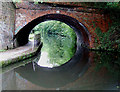
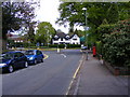
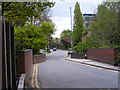
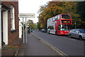
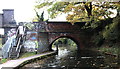
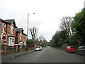
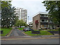
Photos of B15 2SE

Area Information
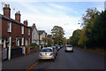
Living in B15 2SE means inhabiting a small, tightly knit residential cluster within Birmingham’s Edgbaston Ward. The area covers 2.1 hectares and is home to 2,444 people, translating to a population density of 1,053 people per square kilometre. Historically part of Warwickshire, this suburban zone has long been associated with affluent residents, a legacy of 19th-century landowners who shaped its character. Today, B15 2SE retains a distinct suburban feel, defined by green spaces, tree-lined streets, and historic private houses. Its proximity to the city centre, combined with a mix of retail, transport, and cultural amenities, makes it appealing to those seeking a balance between urban convenience and residential tranquillity. The area’s compact size means it is both a self-contained community and a gateway to wider Birmingham, with easy access to major landmarks like the University of Birmingham and Edgbaston Golf Club. For buyers, B15 2SE offers a blend of practicality and heritage, though its small footprint means choices are limited to a handful of flats and terraced properties.
- Area Type
- Postcode
- Area Size
- 2.1 hectares
- Population
- 2444
- Population Density
- 1053 people/km²
The property market in B15 2SE is characterised by a 49% home ownership rate, with flats making up the majority of accommodation types. This suggests a rental market that is more prominent than owner-occupied properties, likely due to the area’s compact size and historical development as a suburban enclave. The limited housing stock—concentrated in flats—means the market is relatively small, with few options for buyers seeking larger homes. For those considering purchase, the availability of flats may align with the needs of young professionals or students, though the small footprint of B15 2SE means competition for properties is likely. The area’s proximity to Birmingham’s central amenities, such as the University of Birmingham and nearby transport hubs, could make it an attractive investment for those prioritising location over property size. However, buyers should consider the limited scope for expansion within the immediate vicinity.
House Prices in B15 2SE
Showing 1 properties
| Address | Type | Beds | Baths | Last Sale Price | Last Sale Date | |
|---|---|---|---|---|---|---|
| Health Centre, Pritchatts Road, Birmingham, B15 2SE | pub | - | - | - | - |
Energy Efficiency in B15 2SE
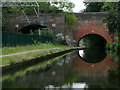
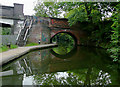
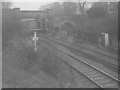
Residents of B15 2SE enjoy a range of amenities within walking or short-vehicle distance. Retail options include Spar, M&S Birmingham QE Hospital, and Tesco Selly Oak Bristol, providing access to daily essentials. The area’s rail and metro connections—such as University Railway Station and Edgbaston Village—offer seamless travel to Birmingham’s cultural and commercial hubs. Parks and green spaces, while not explicitly named in the data, are implied by the area’s suburban character and historical emphasis on tree-lined streets. The proximity to Edgbaston Golf Club and landmarks like the Birmingham Oratory church suggests a community that values leisure and heritage. The mix of retail, transport, and recreational options contributes to a convenient, if compact, lifestyle. However, the limited scope of the postcode means some amenities may require a trip to nearby districts.
Amenities
Schools
Residents of B15 2SE have access to a range of educational institutions, including two independent schools and a higher education facility. King Edward’s School and King Edward VI High School for Girls are both independent institutions, offering selective education options for families seeking private schooling. The University of Birmingham, while not a traditional school, provides postgraduate and higher education opportunities, making the area appealing to students and academics. The mix of independent and higher education options suggests a community that values academic achievement and offers diverse pathways for children and adults alike. However, the absence of state schools in the data means families relying on public education may need to look beyond the immediate postcode. The presence of the University also implies a transient population, which could influence the local school environment.
| Rank | School | Type | Entry gender | Ages |
|---|
Explore more schools in this area
Go to Schools tabDemographics
B15 2SE has a median age of 22, with the majority of residents aged 15–29. This young demographic skews the area’s profile, suggesting a mix of students, early-career professionals, and families. Home ownership stands at 49%, with flats being the predominant accommodation type. This indicates a rental market that is more active than owner-occupied, possibly reflecting the area’s appeal to transient populations. The predominant ethnic group is White, though specific data on diversity is not provided. The high population density—1,053 people per square kilometre—suggests a compact, possibly mixed-use environment. For quality of life, the young age profile may correlate with a dynamic social scene, though the lack of detailed diversity metrics limits broader analysis. The flat-dominated housing stock also implies a focus on affordability over larger family homes, which could influence the area’s appeal to specific buyer segments.
Household Size
Accommodation Type
Tenure
Ethnic Group
Religion
Household Composition
Age
Household Deprivation
NS-SEC
Explore more demographic insights in this area
Go to Demographics tabPlanning
Planning Constraints
- Flood RiskPremium
- Ramsar Wetland SitesPremium
- Area of Outstanding Natural BeautyPremium
- Protected Nature ReservePremium
- Protected WoodlandPremium