Area Overview for B15 2SF
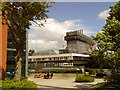
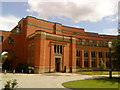
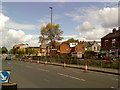
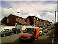
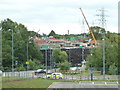
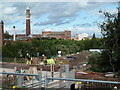
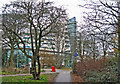
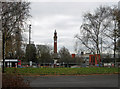
Photos of B15 2SF
Area Information
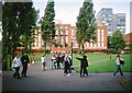
Living in B15 2SF means being part of a small, tightly knit residential cluster in the southwest of Birmingham, England. This postcode sits within the Edgbaston area, historically rooted in Warwickshire, and is just south-west of the city centre. With a population of 2,444 and a density of 1,053 people per square kilometre, the area balances suburban tranquillity with proximity to Birmingham’s urban core. Its character is shaped by green spaces, historic private houses, and a legacy of affluence. The Gough-Calthorpe family once owned much of the land, restricting industrial development to attract wealthy residents. Notable figures like J.R.R. Tolkien and Nick Mason once lived here. Today, the area retains an affluent residential feel, with tree-lined streets and a mix of older homes and modern flats. Its location offers easy access to Birmingham’s cultural and economic hubs, while its historic roots provide a distinct sense of place.
- Area Type
- Postcode
- Area Size
- Not available
- Population
- 2444
- Population Density
- 1053 people/km²
The property market in B15 2SF is characterised by a mix of owner-occupied and rental properties, with 49% of homes owned by residents. Flats dominate the accommodation type, which is typical of areas with higher population density. This suggests a compact housing stock, possibly in multi-unit developments or converted buildings. The small size of the postcode area means that property choices are limited to this immediate cluster, with little variation in housing styles or sizes. For buyers, this could imply a focus on flats rather than detached homes, which may appeal to younger buyers or those prioritising convenience over space. The predominance of flats also indicates a potential rental market, as flats are often more commonly rented in urban areas. However, the lack of data on property prices or recent market trends means the financial dynamics of the area remain opaque.
House Prices in B15 2SF
No properties found in this postcode.
Energy Efficiency in B15 2SF
Residents of B15 2SF have access to a range of amenities within practical reach, including retail outlets, transport hubs, and cultural landmarks. Nearby shops include Spar, Tesco Selly Oak Bristol, and M&S Birmingham QE Hospital, offering everyday convenience. The area’s rail and metro stations—such as University, Selly Oak, and Five Ways—provide easy access to Birmingham’s central districts, Edgbaston Village, and Centenary Square. These transport links also connect to major landmarks like the Town Hall. The area’s character is defined by its green spaces and historic architecture, with sites like Edgbaston Hall and the Birmingham Oratory church adding to its appeal. While the retail options are modest, the proximity to larger urban amenities compensates, making daily life both practical and connected to Birmingham’s broader offerings.
Amenities
Schools
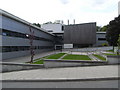
Residents of B15 2SF have access to a range of educational institutions, including two independent schools and a university. King Edward’s School and King Edward VI High School for Girls are both independent institutions, likely catering to families seeking private education. The University of Birmingham, though classified as an “other” type, provides higher education opportunities and may influence the local student population. The presence of independent schools suggests a community that values academic excellence and may attract families prioritising private schooling. However, no Ofsted ratings or specific performance data are provided, so the quality of these institutions remains unquantified. The mix of independent and higher education options offers flexibility for families, though the absence of state schools or primary education facilities is notable, requiring residents to look beyond the immediate area for younger children’s schooling.
| Rank | School | Type | Entry gender | Ages |
|---|
Explore more schools in this area
Go to Schools tabDemographics
The population of B15 2SF is overwhelmingly young, with a median age of 22 and the most common age range being 15–29 years. This suggests a community skewed towards students, young professionals, and families with children. Home ownership stands at 49%, meaning nearly half of residents live in properties they own, while the remaining 51% are likely renters. The predominant accommodation type is flats, reflecting a higher density of housing in this small area. The predominant ethnic group is White, though no specific data on diversity or deprivation levels is provided. The age profile indicates a dynamic, possibly student-heavy population, which may influence local amenities and services. The relatively low median age also suggests a community with active social and economic engagement, though the absence of detailed diversity metrics means broader demographic trends remain unclear.
Household Size
Accommodation Type
Tenure
Ethnic Group
Religion
Household Composition
Age
Household Deprivation
NS-SEC
Explore more demographic insights in this area
Go to Demographics tabPlanning
Planning Constraints
- Flood RiskPremium
- Ramsar Wetland SitesPremium
- Area of Outstanding Natural BeautyPremium
- Protected Nature ReservePremium
- Protected WoodlandPremium