Area Overview for B15 2QE
Photos of B15 2QE


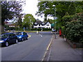
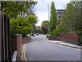
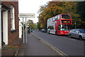
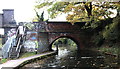
73 photos from this area
Area Information
Key information about the B15 2QE including its size, population, and administrative classification.
- Area Type
- Postcode
- Area Size
- 2.9 hectares
- Population
- 2444
- Population Density
- 1053 people/km²
House Prices in B15 2QE
12
Properties
£755,000
Average Sold Price
£247,500
Lowest Price
£1,375,000
Highest Price
Showing 12 properties
| Address | Type | Beds | Baths | Last Sale Price | Last Sale Date | |
|---|---|---|---|---|---|---|
| 6 Birch Hollow, Birmingham, B15 2QE | Bungalow | 3 | 2 | £780,000 | Jul 2020 | |
| 11 Birch Hollow, Birmingham, B15 2QE | Bungalow | 3 | 2 | £837,500 | Oct 2019 | |
| 9 Birch Hollow, Birmingham, B15 2QE | house | - | - | £1,375,000 | Aug 2019 | |
| 1 Birch Hollow, Birmingham, B15 2QE | Detached | 6 | 5 | £850,000 | Mar 2019 | |
| 15 Birch Hollow, Birmingham, B15 2QE | Detached | 5 | 2 | £900,000 | Dec 2012 | |
| 12 Birch Hollow, Birmingham, B15 2QE | Detached | - | - | £295,000 | Nov 1998 | |
| 4 Birch Hollow, Birmingham, B15 2QE | Detached | 4 | 2 | £247,500 | Nov 1997 | |
| 2 Birch Hollow, Birmingham, B15 2QE | Detached | 5 | 3 | - | - | |
| 8 Birch Hollow, Birmingham, B15 2QE | Detached | - | - | - | - | |
| 10 Birch Hollow, Birmingham, B15 2QE | Detached | - | - | - | - |
Page 1 of 2
Energy Efficiency in B15 2QE
Amenities
Schools
| Rank | School | Type | Entry gender | Ages |
|---|
Explore more schools in this area
Go to Schools tabDemographics
Household Size
One person
most common
Accommodation Type
Flats
most common
Tenure
49
majority
Ethnic Group
White
most common
Religion
N/A
most common
Household Composition
N/A
most common
Age
22
median
Young Adults (15-29 years)
most common
Household Deprivation
N/A
with no deprivation
NS-SEC
20
in Lower managerial occupations
Explore more demographic insights in this area
Go to Demographics tabPlanning
Planning Constraints
- Flood RiskPremium
- Ramsar Wetland SitesPremium
- Area of Outstanding Natural BeautyPremium
- Protected Nature ReservePremium
- Protected WoodlandPremium