Area Overview for B15 1RX
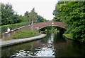
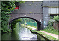
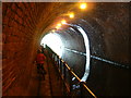
Photos of B15 1RX

Area Information
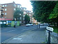
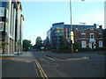
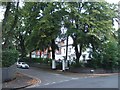
Living in B15 1RX means inhabiting a compact, suburban enclave within Birmingham’s Edgbaston area, where history and modernity intersect. The postcode covers 9,835 square metres, housing 2,702 residents in a densely populated 274,744 people per square kilometre. This small cluster of homes sits in a historically affluent part of Birmingham, once shaped by wealthy landowners who prioritised green spaces and private residences. Today, it retains a suburban character defined by trees, gardens, and historic architecture. The area’s proximity to Birmingham’s city centre offers easy access to urban amenities, while its quieter streets and low crime rates provide a sense of security. With a median age of 22 and a majority of young adults, the community feels dynamic, yet rooted in the traditions of a place once linked to figures like J.R.R. Tolkien and Cardinal Newman. Daily life here balances proximity to retail, transport, and cultural hubs with the tranquillity of a residential neighbourhood.
- Area Type
- Postcode
- Area Size
- 9835 m²
- Population
- 2702
- Population Density
- 4130 people/km²
The property market in B15 1RX is characterised by high home ownership (72%) and a focus on houses rather than flats or apartments. This suggests a market oriented towards owner-occupiers seeking private, standalone homes, likely attracting young professionals and families. Given the area’s small size and high population density, the housing stock is limited but concentrated, with properties likely to be older, reflecting Edgbaston’s historical development. The predominance of houses may indicate a lack of high-density housing, which could limit options for renters or first-time buyers. However, the area’s proximity to Birmingham’s city centre and its reputation as an affluent suburb may support property values. For buyers, this small postcode area offers a mix of stability and potential for long-term investment, though the limited size means competition for available properties.
House Prices in B15 1RX
Showing 1 properties
| Address | Type | Beds | Baths | Last Sale Price | Last Sale Date | |
|---|---|---|---|---|---|---|
| Tennis 73M From St Georges School, 31 Calthorpe Road 107M From B4217, The Paddocks, Birmingham, B15 1RX | Leisure | - | - | - | - |
Energy Efficiency in B15 1RX
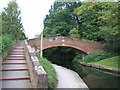
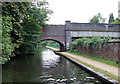
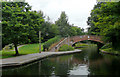
Residents of B15 1RX enjoy a range of nearby amenities, from retail to leisure. The area is served by five retail outlets, including Morrisons Edgbaston, Co-op Edgbaston, and Spar Edgbaston, offering everyday shopping needs. Metro areas like Edgbaston Village and Centenary Square provide access to cultural and commercial spaces, while the nearby Town Hall adds a civic dimension. Rail stations within walking distance connect residents to Birmingham’s transport network, facilitating travel to work, education, or leisure. The area’s suburban character is complemented by its proximity to parks and green spaces, though specific names are not listed. The combination of retail, transport, and urban access creates a lifestyle that balances convenience with the tranquillity of a residential suburb.
Amenities
Schools
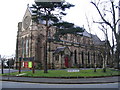
Residents of B15 1RX have access to three independent schools: St George’s School Edgbaston, Hallfield School, and Accelerated Tutorial School. All three are private institutions, offering alternatives to state education. Independent schools often provide smaller class sizes, specialised curricula, and strong extracurricular programmes, which may appeal to families prioritising tailored education. However, the absence of state schools in the data suggests that families relying on public education may need to look beyond the immediate area. The concentration of independent schools indicates a community that values private schooling, potentially aligning with the area’s historical association with affluent residents. For those seeking non-state education, the proximity of these schools could be a significant advantage.
| Rank | School | Type | Entry gender | Ages |
|---|
Explore more schools in this area
Go to Schools tabDemographics
The population of B15 1RX is overwhelmingly young, with a median age of 22 and 72% of residents aged between 15 and 29. This demographic skew suggests a community centred on students, early-career professionals, and young families. Home ownership is high at 72%, indicating a stable, long-term resident base. The accommodation type is predominantly houses, reflecting a preference for private, standalone properties over flats. The predominant ethnic group is White, though specific diversity statistics are not provided. The high population density—274,744 people per square kilometre—means the area is compact, with limited open space. For young residents, this density may foster a lively, interconnected community, though it also places demands on local amenities and infrastructure. The absence of detailed deprivation data means quality of life factors like access to services and transport must be inferred from the available data.
Household Size
Accommodation Type
Tenure
Ethnic Group
Religion
Household Composition
Age
Household Deprivation
NS-SEC
Explore more demographic insights in this area
Go to Demographics tabPlanning
Planning Constraints
- Flood RiskPremium
- Ramsar Wetland SitesPremium
- Area of Outstanding Natural BeautyPremium
- Protected Nature ReservePremium
- Protected WoodlandPremium