Area Overview for B15 1TU
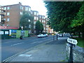
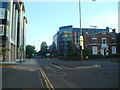
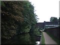
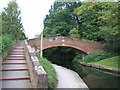
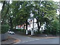
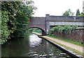
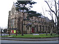
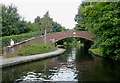
Photos of B15 1TU


Area Information
B15 1TU is a specific postcode covering a small residential cluster within the broader Edgbaston Ward in Birmingham. This area forms part of the southwest suburbs, sitting just south-west of the city centre. Historically, the wider Edgbaston region evolved from Warwickshire, and its character was shaped in the 19th century when the Gough-Calthorpe family owned vast tracts of land. They banned factories to attract wealthy residents, establishing an affluent feel that persists today. The current population of this specific postcode cluster is 1,586 people, though the wider Edgbaston population reached 18,732 in recent records. You will find this area defined by green spaces, mature trees, and historic private houses rather than high-density urban blocks. Local landmarks include the Grade I listed house at 21 Yateley Road and the Birmingham Oratory church on Hagley Road. Notable figures such as J.R.R. Tolkien and Nick Mason are associated with the area's history. Living in B15 1TU offers access to a tranquil environment close to major city amenities. The location balances suburban quiet with the convenience of being near Birmingham's business and cultural hubs.
- Area Type
- Postcode
- Area Size
- Not available
- Population
- 1586
- Population Density
- 3154 people/km²
The housing market in B15 1TU leans heavily towards flat living, as flats are the predominant accommodation type in this postcode. With only 45% home ownership rates, the area presents a mixed landscape of owner-occupied properties and rented accommodation. This statistic implies that a significant number of residents either rent their flats or invest in rental properties rather than living there themselves. For buyers searching for homes in B15 1TU, the focus should shift towards finding a suitable flat within a small residential cluster rather than seeking detached houses or semi-detached homes. The specific nature of this postcode, described as a tight-knit cluster, suggests limited land availability for large-scale new developments. You will find that the local housing stock reflects the historical development patterns of Edgbaston, which values density and established character over expansive garden plots. Understanding that nearly half of residents do not own their homes helps contextualize price stability and rental demand in this specific sector of Birmingham.
House Prices in B15 1TU
No properties found in this postcode.
Energy Efficiency in B15 1TU
Residents of B15 1TU benefit from a wide range of amenities within practical reach. There are five retail outlets nearby, including Morrisons Edgbaston, Co-op Edgbaston, and Spar Edgbaston. These supermarkets provide immediate access to groceries and everyday essentials without needing long travel. Transport links are extensive, with five metro locations, five railway stations, and five other transit points nearby. Notable rail hubs include Five Ways Railway Station, University Railway Station, and Birmingham Snow Hill Railway Station. These stations facilitate easy commuting into the city centre or access to University of Birmingham campuses. Five metro locations mentioned are Edgbaston Village, Centenary Square, and Town Hall, offering variety in cultural and shopping experiences. The area is defined by its green spaces and historic character, complemented by these convenient facilities. Living in B15 1TU means you can shop at Morrisons or Co-op while keeping your commute short via the nearby railway network. This blend of suburban tranquility and urban convenience defines the daily experience for everyone residing in this specific postcode.
Amenities
Schools
Families living in B15 1TU have access to two notable independent schools in the immediate vicinity. These are West House School and Edgbaston College. Edgbaston College holds an Ofsted rating of good, providing a verified standard of education for prospective parents. Both institutions are private schools, offering an alternative to the state sector for families who can afford the associated fees. The presence of these specific schools indicates a neighbourhood with higher-than-average spending power regarding education. Since no state-maintained schools are listed in the provided data for this postcode, options for state education lie further away. The mix of independent schooling supports a demographic profile where median age is 47 and home ownership is significant. Homebuyers considering this area must weigh the need to commute to other catchment areas if they require state schools for younger children. The proximity to independent schools like Edgbaston College reinforces the area's positioning as a residential hub for affluent families.
| Rank | School | Type | Entry gender | Ages |
|---|
Explore more schools in this area
Go to Schools tabDemographics
The community in B15 1TU reflects a mature demographic profile with a median age of 47 years. Adults aged between 30 and 64 years represent the most common age range within the population. This data suggests an established neighbourhood where families and older couples dominate the residential landscape. Home ownership stands at 45% for this area, indicating a significant portion of residents own their properties outright or with mortgages. The majority of accommodation consists of flats, which aligns with the urban edge location of this postcode within Birmingham. The predominant ethnic group is White, although no further breakdown of other groups is available for this specific cluster. With a median age nearing 47, you may encounter a quiet atmosphere suited to professionals later in their careers or those nearing retirement. The high concentration of adults in the 30-64 bracket means you are unlikely to find the area conducive to young children's schooling compared to more youthful boroughs. This demographic stability often contributes to lower turnover rates, fostering a sense of community cohesion among long-term residents.
Household Size
Accommodation Type
Tenure
Ethnic Group
Religion
Household Composition
Age
Household Deprivation
NS-SEC
Explore more demographic insights in this area
Go to Demographics tabPlanning
Planning Constraints
- Flood RiskPremium
- Ramsar Wetland SitesPremium
- Area of Outstanding Natural BeautyPremium
- Protected Nature ReservePremium
- Protected WoodlandPremium