Area Overview for B14 7NH
Photos of B14 7NH
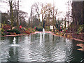
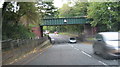
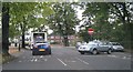
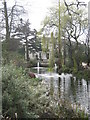
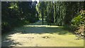
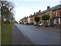
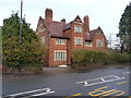
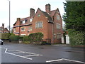
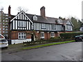
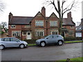

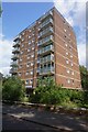
33 photos from this area
Area Information
Key information about the B14 7NH including its size, population, and administrative classification.
- Area Type
- Postcode
- Area Size
- 2.2 hectares
- Population
- 1489
- Population Density
- 3035 people/km²
House Prices in B14 7NH
30
Properties
£222,944
Average Sold Price
£22,000
Lowest Price
£478,500
Highest Price
Showing 30 properties
| Address | Type | Beds | Baths | Last Sale Price | Last Sale Date | |
|---|---|---|---|---|---|---|
| 282A Vicarage Road, Brandwood, Birmingham, B14 7NH | Flat | - | - | £180,000 | Feb 2021 | |
| 258 Vicarage Road, Brandwood, Birmingham, B14 7NH | Semi-detached | 6 | - | £478,500 | Jul 2019 | |
| 260 Vicarage Road, Brandwood, Birmingham, B14 7NH | Semi-detached | 1 | 1 | £349,000 | Dec 2017 | |
| 296A Vicarage Road, Brandwood, Birmingham, B14 7NH | Flat | - | - | £130,000 | Feb 2017 | |
| 276A Vicarage Road, Brandwood, Birmingham, B14 7NH | Flat | - | - | £195,000 | Dec 2006 | |
| 298A Vicarage Road, Brandwood, Birmingham, B14 7NH | Flat | - | - | £222,000 | Nov 2006 | |
| 310 Vicarage Road, Brandwood, Birmingham, B14 7NH | Detached | 5 | 1 | £250,000 | Jun 2004 | |
| 308 Vicarage Road, Brandwood, Birmingham, B14 7NH | Flat | - | - | £180,000 | Sep 2002 | |
| 272A Vicarage Road, Brandwood, Birmingham, B14 7NH | Flat | - | - | £22,000 | Jun 1999 | |
| 264B Vicarage Road, Brandwood, Birmingham, B14 7NH | Detached | 12 | 4 | - | - |
Page 1 of 3
Energy Efficiency in B14 7NH
Amenities
Schools
| Rank | School | Type | Entry gender | Ages |
|---|
Explore more schools in this area
Go to Schools tabDemographics
Household Size
Family (3-5 people)
most common
Accommodation Type
Houses
most common
Tenure
63
majority
Ethnic Group
White
most common
Religion
N/A
most common
Household Composition
N/A
most common
Age
47
median
Adults (30-64 years)
most common
Household Deprivation
N/A
with no deprivation
NS-SEC
32
in Lower managerial occupations
Explore more demographic insights in this area
Go to Demographics tabPlanning
Planning Constraints
- Flood RiskPremium
- Ramsar Wetland SitesPremium
- Area of Outstanding Natural BeautyPremium
- Protected Nature ReservePremium
- Protected WoodlandPremium