Area Overview for B14 4AG
Photos of B14 4AG
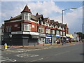
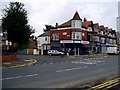
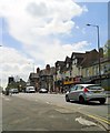
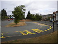
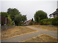
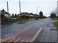

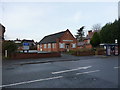
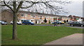

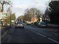
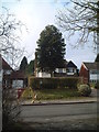
20 photos from this area
Area Information
Key information about the B14 4AG including its size, population, and administrative classification.
- Area Type
- Postcode
- Area Size
- 2.4 hectares
- Population
- Not available
- Population Density
- Not available
House Prices in B14 4AG
62
Properties
£208,871
Average Sold Price
£53,750
Lowest Price
£425,000
Highest Price
Showing 62 properties
| Address | Type | Beds | Baths | Last Sale Price | Last Sale Date | |
|---|---|---|---|---|---|---|
| 66 May Lane, Birmingham, B14 4AG | Terraced | 2 | 1 | £282,050 | Sep 2025 | |
| 164 May Lane, Birmingham, B14 4AG | Detached | 3 | 1 | £425,000 | Aug 2025 | |
| 148 May Lane, Birmingham, B14 4AG | Terraced | 3 | 1 | £324,500 | May 2025 | |
| 70 May Lane, Birmingham, B14 4AG | house | - | - | £150,000 | Feb 2025 | |
| 146 May Lane, Birmingham, B14 4AG | Terraced | 2 | 1 | £238,000 | Sep 2023 | |
| 140 May Lane, Birmingham, B14 4AG | Terraced | 2 | 1 | £305,000 | Apr 2023 | |
| 74 May Lane, Birmingham, B14 4AG | Terraced | 2 | 1 | £320,000 | Sep 2022 | |
| 156 May Lane, Birmingham, B14 4AG | Terraced | 2 | 1 | £216,000 | Aug 2022 | |
| 118 May Lane, Birmingham, B14 4AG | Retail | 2 | 1 | £262,000 | Jun 2022 | |
| 98 May Lane, Birmingham, B14 4AG | Terraced | 2 | 1 | £250,000 | Aug 2021 |
Page 1 of 7
Energy Efficiency in B14 4AG
Amenities
Schools
| Rank | School | Type | Entry gender | Ages |
|---|
Explore more schools in this area
Go to Schools tabDemographics
Household Size
Family (3-5 people)
most common
Accommodation Type
Houses
most common
Tenure
73
majority
Ethnic Group
White
most common
Religion
N/A
most common
Household Composition
N/A
most common
Age
47
median
Adults (30-64 years)
most common
Household Deprivation
N/A
with no deprivation
NS-SEC
38
in Lower managerial occupations
Explore more demographic insights in this area
Go to Demographics tabPlanning
Planning Constraints
- Flood RiskPremium
- Ramsar Wetland SitesPremium
- Area of Outstanding Natural BeautyPremium
- Protected Nature ReservePremium
- Protected WoodlandPremium