Area Overview for B13 9HD
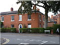
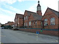
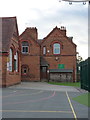
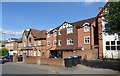
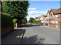
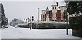
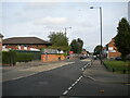
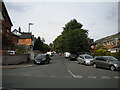
Photos of B13 9HD
Area Information
Living in B13 9HD means being part of a compact, densely populated residential cluster in the heart of Birmingham’s Moseley area. This postcode covers just 1,743 square metres, yet it houses 1,188 people, translating to a population density of over 680,000 per square kilometre. Historically, Moseley evolved from a rural village into a middle-class suburb during the 19th century, shaped by railway expansion and the development of public spaces like Cannon Hill Park. Today, it retains a mix of historical character and modern convenience. Residents benefit from proximity to Birmingham’s transport networks, including multiple rail stations and metro stops, while nearby amenities such as Moseley Park and local shops offer daily essentials. The area’s compact size means most needs are within walking distance, though its small footprint also means housing options are limited to flats, reflecting a rental-dominated market. For those seeking a blend of heritage and urban connectivity, B13 9HD offers a distinct slice of Birmingham’s suburban identity.
- Area Type
- Postcode
- Area Size
- 1743 m²
- Population
- 1188
- Population Density
- 5665 people/km²
The property market in B13 9HD is characterised by a high concentration of flats, with home ownership at 41%. This suggests that the area is more rental-focused than owner-occupied, reflecting the typical dynamics of a small, densely populated postcode. The limited land area of 1,743 square metres means housing stock is constrained, with little scope for new developments. For buyers, this implies that available properties are likely to be flats in established buildings, rather than detached or semi-detached homes. The rental market may offer opportunities for investors, but for owner-occupiers, the scarcity of available properties could drive competition. Proximity to transport links and amenities may offset the challenges of limited housing options, though buyers should consider the area’s compact nature when evaluating long-term suitability.
House Prices in B13 9HD
No properties found in this postcode.
Energy Efficiency in B13 9HD
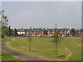
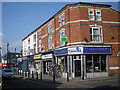
Life in B13 9HD is shaped by its proximity to retail, green spaces, and cultural landmarks. Within walking distance are five retail outlets, including M&S Moseley, Co-op Moseley, and Lidl Sparkbrook, offering everyday shopping needs. The area’s parks, such as Moseley Park and Pool and Cannon Hill Park, provide recreational space, with the latter established from donated land in 1873. Historical sites like Spring Hill College and the Moseley Tunnel add a layer of heritage to daily life. The compact nature of the postcode means amenities are clustered closely, encouraging a walkable lifestyle. However, the limited size of the area may restrict access to larger leisure facilities, requiring residents to venture slightly further for options like cinemas or larger retail centres.
Amenities
Schools
The primary school nearest to B13 9HD is St Martin de Porres Catholic Primary School, which holds an Ofsted rating of ‘good’. This institution serves the local community with a focus on Catholic education, though no secondary schools are listed in the data. The presence of a ‘good’-rated primary school is a key consideration for families with young children, offering a reliable foundation for early education. However, parents seeking secondary schooling may need to look beyond the immediate area, as no further schools are detailed. The single listed school highlights the importance of assessing broader educational options when considering B13 9HD as a long-term residence.
| Rank | School | Type | Entry gender | Ages |
|---|
Explore more schools in this area
Go to Schools tabDemographics
The community in B13 9HD is predominantly middle-aged, with a median age of 47 and the most common age range being adults aged 30–64. Home ownership accounts for 41% of properties, indicating a rental-heavy market, with flats being the primary accommodation type. The predominant ethnic group is White, though specific data on diversity beyond this is not provided. The population density of 681,645 per square kilometre suggests a tightly packed residential area, which may influence the character of daily life. With a mature demographic profile, the area likely reflects a stable, long-term resident base. However, the high proportion of renters and the absence of detailed deprivation data mean that affordability and housing availability could be pressing concerns for potential buyers or new arrivals.
Household Size
Accommodation Type
Tenure
Ethnic Group
Religion
Household Composition
Age
Household Deprivation
NS-SEC
Explore more demographic insights in this area
Go to Demographics tabPlanning
Planning Constraints
- Flood RiskPremium
- Ramsar Wetland SitesPremium
- Area of Outstanding Natural BeautyPremium
- Protected Nature ReservePremium
- Protected WoodlandPremium