Area Overview for B13 9EN
Photos of B13 9EN
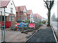
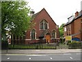
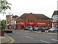
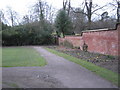
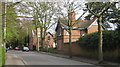
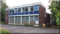

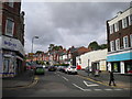
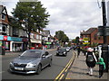
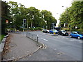
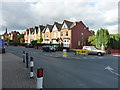
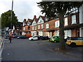
80 photos from this area
Area Information
Key information about the B13 9EN including its size, population, and administrative classification.
- Area Type
- Postcode
- Area Size
- 1.5 hectares
- Population
- 1490
- Population Density
- 4631 people/km²
House Prices in B13 9EN
33
Properties
£400,497
Average Sold Price
£12,500
Lowest Price
£750,000
Highest Price
Showing 33 properties
| Address | Type | Beds | Baths | Last Sale Price | Last Sale Date | |
|---|---|---|---|---|---|---|
| 35 Ascot Road, Birmingham, B13 9EN | Detached | 5 | 1 | £625,000 | Mar 2024 | |
| 19 Ascot Road, Birmingham, B13 9EN | house | 4 | 2 | £675,000 | Aug 2023 | |
| 55 Ascot Road, Birmingham, B13 9EN | Semi-detached | 5 | - | £565,000 | Jul 2021 | |
| 59 Ascot Road, Birmingham, B13 9EN | Semi-detached | 3 | - | £465,000 | Nov 2020 | |
| 3 Ascot Road, Birmingham, B13 9EN | Semi-detached | 6 | 3 | £750,000 | May 2018 | |
| 57 Ascot Road, Birmingham, B13 9EN | Semi-detached | 3 | - | £400,000 | Feb 2018 | |
| 7 Ascot Road, Birmingham, B13 9EN | Detached | 6 | 2 | £489,950 | Jul 2013 | |
| 51 Ascot Road, Birmingham, B13 9EN | Semi-detached | 5 | - | £345,000 | Jul 2013 | |
| 43 Ascot Road, Birmingham, B13 9EN | Semi-detached | 4 | - | £270,000 | Jun 2013 | |
| 15 Ascot Road, Birmingham, B13 9EN | Semi-detached | 5 | - | £438,000 | Feb 2013 |
Page 1 of 4
Energy Efficiency in B13 9EN
Amenities
Schools
| Rank | School | Type | Entry gender | Ages |
|---|
Explore more schools in this area
Go to Schools tabDemographics
Household Size
One person
most common
Accommodation Type
Houses
most common
Tenure
62
majority
Ethnic Group
White
most common
Religion
N/A
most common
Household Composition
N/A
most common
Age
47
median
Adults (30-64 years)
most common
Household Deprivation
N/A
with no deprivation
NS-SEC
54
in Lower managerial occupations
Explore more demographic insights in this area
Go to Demographics tabPlanning
Planning Constraints
- Flood RiskPremium
- Ramsar Wetland SitesPremium
- Area of Outstanding Natural BeautyPremium
- Protected Nature ReservePremium
- Protected WoodlandPremium