Area Overview for B13 9DQ
Photos of B13 9DQ
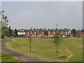
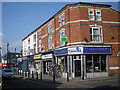
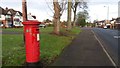
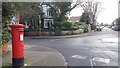
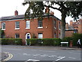
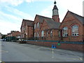
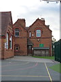
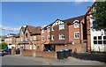
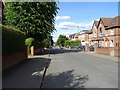
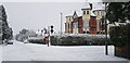
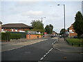
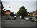
37 photos from this area
Area Information
Key information about the B13 9DQ including its size, population, and administrative classification.
- Area Type
- Postcode
- Area Size
- 2.1 hectares
- Population
- 1580
- Population Density
- 8161 people/km²
House Prices in B13 9DQ
62
Properties
£302,800
Average Sold Price
£245,000
Lowest Price
£445,000
Highest Price
Showing 62 properties
| Address | Type | Beds | Baths | Last Sale Price | Last Sale Date | |
|---|---|---|---|---|---|---|
| 139 Anderton Park Road, Moseley And Kings Heath, Birmingham, B13 9DQ | Semi-detached | 4 | 3 | £294,000 | Oct 2015 | |
| 141 Anderton Park Road, Moseley And Kings Heath, Birmingham, B13 9DQ | Terraced | 4 | 3 | £285,000 | Mar 2014 | |
| 132 Anderton Park Road, Moseley And Kings Heath, Birmingham, B13 9DQ | Detached | - | - | £445,000 | Jan 2009 | |
| 143 Anderton Park Road, Moseley And Kings Heath, Birmingham, B13 9DQ | Terraced | - | - | £245,000 | Nov 2002 | |
| 137 Anderton Park Road, Moseley And Kings Heath, Birmingham, B13 9DQ | house | 5 | - | £245,000 | Jul 2002 | |
| Flat 3, 121 Anderton Park Road, Moseley And Kings Heath, Birmingham, B13 9DQ | Flat | 2 | 1 | - | - | |
| 117 Anderton Park Road, Moseley And Kings Heath, Birmingham, B13 9DQ | Semi-detached | 6 | 3 | - | - | |
| 123 Anderton Park Road, Moseley And Kings Heath, Birmingham, B13 9DQ | Semi-detached | 8 | 3 | - | - | |
| 113-115 Anderton Park Road, Moseley And Kings Heath, Birmingham, B13 9DQ | Detached | 24 | - | - | - | |
| 122 Anderton Park Road, Moseley And Kings Heath, Birmingham, B13 9DQ | Detached | 6 | 2 | - | - |
Page 1 of 7
Energy Efficiency in B13 9DQ
Amenities
Schools
| Rank | School | Type | Entry gender | Ages |
|---|
Explore more schools in this area
Go to Schools tabDemographics
Household Size
One person
most common
Accommodation Type
Flats
most common
Tenure
32
majority
Ethnic Group
asian_total
most common
Religion
N/A
most common
Household Composition
N/A
most common
Age
47
median
Adults (30-64 years)
most common
Household Deprivation
N/A
with no deprivation
NS-SEC
31
in Lower managerial occupations
Explore more demographic insights in this area
Go to Demographics tabPlanning
Planning Constraints
- Flood RiskPremium
- Ramsar Wetland SitesPremium
- Area of Outstanding Natural BeautyPremium
- Protected Nature ReservePremium
- Protected WoodlandPremium