Area Overview for B12 9NU
Photos of B12 9NU
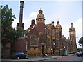
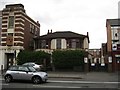
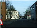
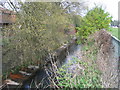
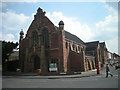
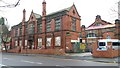
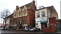
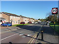
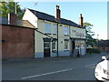
79 photos from this area
Area Information
Key information about the B12 9NU including its size, population, and administrative classification.
- Area Type
- Postcode
- Area Size
- 9419 m²
- Population
- 1937
- Population Density
- 12965 people/km²
House Prices in B12 9NU
26
Properties
£170,084
Average Sold Price
£21,000
Lowest Price
£297,840
Highest Price
Showing 26 properties
| Address | Type | Beds | Baths | Last Sale Price | Last Sale Date | |
|---|---|---|---|---|---|---|
| 71 Jakeman Road, Birmingham, B12 9NU | Terraced | 3 | 2 | £270,000 | Mar 2025 | |
| 81 Jakeman Road, Birmingham, B12 9NU | Terraced | 4 | 2 | £297,840 | May 2023 | |
| 77 Jakeman Road, Birmingham, B12 9NU | Retail | 2 | 1 | £210,000 | Jun 2022 | |
| 107 Jakeman Road, Birmingham, B12 9NU | house | - | - | £250,000 | Jun 2015 | |
| 95 Jakeman Road, Birmingham, B12 9NU | house | - | - | £200,000 | Jan 2011 | |
| 67 Jakeman Road, Birmingham, B12 9NU | Terraced | 3 | 1 | £21,000 | Nov 2009 | |
| 103 Jakeman Road, Birmingham, B12 9NU | Terraced | 5 | 3 | £185,000 | Nov 2009 | |
| 85 Jakeman Road, Birmingham, B12 9NU | Terraced | - | - | £182,000 | Apr 2006 | |
| 75 Jakeman Road, Birmingham, B12 9NU | Terraced | - | - | £50,000 | Oct 2000 | |
| 59 Jakeman Road, Birmingham, B12 9NU | house | - | - | £35,000 | Jul 1995 |
Page 1 of 3
Energy Efficiency in B12 9NU
Amenities
Schools
| Rank | School | Type | Entry gender | Ages |
|---|
Explore more schools in this area
Go to Schools tabDemographics
Household Size
Family (3-5 people)
most common
Accommodation Type
Houses
most common
Tenure
49
majority
Ethnic Group
asian_total
most common
Religion
N/A
most common
Household Composition
N/A
most common
Age
22
median
Adults (30-64 years)
most common
Household Deprivation
N/A
with no deprivation
NS-SEC
15
in Lower managerial occupations
Explore more demographic insights in this area
Go to Demographics tabPlanning
Planning Constraints
- Flood RiskPremium
- Ramsar Wetland SitesPremium
- Area of Outstanding Natural BeautyPremium
- Protected Nature ReservePremium
- Protected WoodlandPremium