Area Overview for B12 9NY
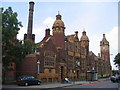
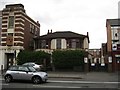
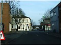
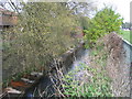
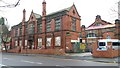
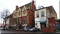
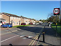
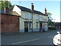
Photos of B12 9NY
Area Information
B12 9NY lies within the Balsall Heath West electoral ward of Birmingham, a historically rural area transformed by urban expansion. With a population of 1,937, it is a compact residential cluster characterised by a blend of older housing stock and post-war development. The area’s proximity to Birmingham’s city centre, coupled with its small-scale charm, makes it appealing to those seeking a quieter alternative to the metropolis. Balsall Heath itself has roots in 13th-century farmland, later becoming a hub for industry and transport. Today, it is home to a diverse community, with the Asian population forming the largest ethnic group. The area’s parks, including Calthorpe Park and Balsall Heath Park, offer green spaces for recreation, while nearby railway stations provide swift access to Birmingham’s business districts. Despite its modest size, B12 9NY combines historical significance with modern convenience, offering a distinct identity shaped by its past as a red-light district and its current role as a multicultural, family-oriented neighbourhood.
- Area Type
- Postcode
- Area Size
- Not available
- Population
- 1937
- Population Density
- 12965 people/km²
The property market in B12 9NY is characterised by a 49% home ownership rate, suggesting that the area is more rental-oriented than owner-occupied. The accommodation type is predominantly houses, which is atypical for inner-city Birmingham, where terraced and semi-detached housing dominate. This may indicate a mix of older, larger homes and post-war developments, offering potential buyers a range of property styles. However, the small population and limited area size mean the housing stock is unlikely to be extensive. Buyers should consider the area’s proximity to transport links, such as nearby railway stations, and its proximity to Birmingham’s city centre, which may enhance property value. The predominance of houses over flats also suggests a focus on family living, though the lower home ownership rate may reflect affordability challenges or a transient population.
House Prices in B12 9NY
No properties found in this postcode.
Energy Efficiency in B12 9NY
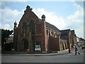
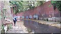
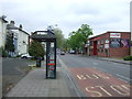
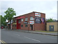
Residents of B12 9NY have access to a range of amenities within practical reach. Retail options include Lidl Sparkbrook, Morrisons Daily, and Aldi Edgbaston, offering everyday shopping convenience. The area’s transport links connect it to Birmingham’s cultural and commercial centres, with railway stations providing swift access to the city’s landmarks. Parks such as Calthorpe Park and Balsall Heath Park offer green spaces for leisure, while historic sites like the Balsall Heath Library (opened 1895) and the Shia Mosque on Clifton Road reflect the area’s diverse heritage. The presence of Balsall Heath City Farm and local initiatives like the Balsall Heath Forum highlight a community-focused lifestyle. The mix of retail, green spaces, and cultural landmarks ensures a balanced daily life, blending practicality with a sense of place.
Amenities
Schools
| Rank | School | Type | Entry gender | Ages |
|---|
Explore more schools in this area
Go to Schools tabDemographics
The population of B12 9NY is 1,937, with a median age of 22, though the most common age range is adults aged 30–64. This suggests a mix of younger residents and families, though the area’s demographic profile is skewed by the presence of a large Asian community, which forms the predominant ethnic group. Home ownership stands at 49%, indicating that over half of residents are renters, likely influenced by the area’s history of social housing and urban renewal. The accommodation type is predominantly houses, not flats, which is unusual for inner-city Birmingham. This suggests a focus on family homes rather than high-density living. The low home ownership rate and the presence of a significant Asian population point to a community shaped by migration and economic factors, with implications for local services and social cohesion.
Household Size
Accommodation Type
Tenure
Ethnic Group
Religion
Household Composition
Age
Household Deprivation
NS-SEC
Explore more demographic insights in this area
Go to Demographics tabPlanning
Planning Constraints
- Flood RiskPremium
- Ramsar Wetland SitesPremium
- Area of Outstanding Natural BeautyPremium
- Protected Nature ReservePremium
- Protected WoodlandPremium