Area Overview for B12 0QX
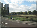
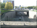
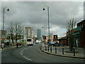
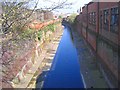
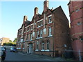
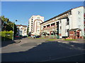
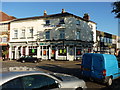
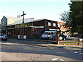
Photos of B12 0QX
Area Information
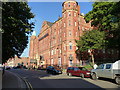
Living in B12 0QX means inhabiting a densely populated, small-scale residential cluster in central Birmingham. The area covers 5,008 m² and is home to 1,582 people, equating to a staggering 315,888 people per km² — a density that reflects its compact urban character. Situated in the Bordesley and Highgate ward, this postcode is part of Birmingham’s historic core, encompassing areas like Digbeth and Highgate. Its proximity to the city centre means residents enjoy easy access to Birmingham’s cultural and economic hubs. The area’s history dates back to the 7th century, with Bordesley’s name derived from Old English, reflecting its long-standing role as a settlement. Daily life here is shaped by its proximity to transport networks, retail, and historical sites. While the area is small, its connectivity to rail and metro stations, along with nearby amenities, makes it a practical choice for those prioritising convenience over space. However, the high population density and limited green spaces mean living here requires adapting to a fast-paced, urban environment.
- Area Type
- Postcode
- Area Size
- 5008 m²
- Population
- 1582
- Population Density
- 3153 people/km²
The property market in B12 0QX is characterised by a high proportion of rental properties, with only 20% of homes owner-occupied. Flats dominate the housing stock, reflecting the area’s small footprint and urban layout. This suggests limited availability of larger homes or detached properties, which may be a challenge for buyers seeking more space. The compact nature of the postcode means housing options are constrained, and proximity to transport and amenities is likely a key consideration for buyers. Given the high population density, properties here are likely to be in high demand, particularly for those prioritising convenience over size. Investors may find opportunities in the rental market, but buyers should be prepared for limited choices and potentially higher competition. The flat-dominated stock also implies a focus on affordability, though specific price data is not provided.
House Prices in B12 0QX
No properties found in this postcode.
Energy Efficiency in B12 0QX
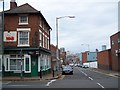
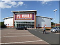
Life in B12 0QX is defined by proximity to retail, transport, and historical sites. The area’s retail offerings include Tesco Birmingham, Spar, and Morrisons Daily Bristol, providing essential shopping options within walking distance. Rail and metro stations like Bordesley and Grand Central New Street ensure easy access to Birmingham’s commercial and cultural centres. While the data does not mention parks or leisure facilities, the area’s historical significance — including Digbeth’s industrial heritage — adds a unique character to daily life. Residents can explore nearby sites like Bordesley Hall, though its historical buildings are now demolished. The compact nature of the postcode means amenities are concentrated, offering convenience but limited space for sprawling recreational activities. For those who prioritise accessibility over expansive green spaces, B12 0QX provides a practical, urban lifestyle with a focus on connectivity and proximity to services.
Amenities
Schools
The nearest school to B12 0QX is Chandos Primary School, which serves the area’s primary education needs. The school is listed twice in the data, both times with a type of “primary” and an Ofsted rating of “satisfactory.” This indicates a single primary school option for families in the vicinity, which may limit choices for parents seeking alternative educational environments. The satisfactory rating suggests the school meets basic standards but may not excel in areas like academic performance or extracurricular offerings. For families relying on this school, the lack of secondary options nearby could be a consideration, though the data does not specify secondary institutions. The presence of a primary school within practical reach is a practical benefit, but the absence of additional schools may require families to travel for higher education.
| Rank | School | Type | Entry gender | Ages |
|---|
Explore more schools in this area
Go to Schools tabDemographics
The community in B12 0QX is predominantly composed of adults aged 30–64, despite a median age of 22. This suggests a mix of younger residents and a larger proportion of middle-aged individuals. Only 20% of households are owner-occupied, with flats being the primary accommodation type. This indicates a rental-dominated market, likely driven by the area’s compact size and limited housing diversity. The predominant ethnic group is White, though no specific data on diversity beyond this is provided. The population density of 315,888 people per km² is exceptionally high, which may impact quality of life by increasing demand for shared spaces and services. For buyers, this density means competition for property and a focus on proximity to amenities rather than private outdoor space. The age profile suggests a stable, working-age population, but the low home ownership rate points to a transient or rental-focused demographic.
Household Size
Accommodation Type
Tenure
Ethnic Group
Religion
Household Composition
Age
Household Deprivation
NS-SEC
Explore more demographic insights in this area
Go to Demographics tabPlanning
Planning Constraints
- Flood RiskPremium
- Ramsar Wetland SitesPremium
- Area of Outstanding Natural BeautyPremium
- Protected Nature ReservePremium
- Protected WoodlandPremium