Area Overview for B12 0SB
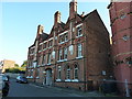
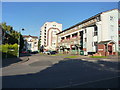
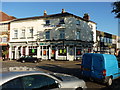
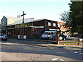
Photos of B12 0SB
Area Information
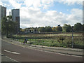
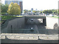
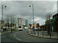
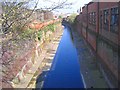
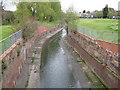
B12 0SB represents a small residential cluster within the Bordesley and Highgate electoral ward in the centre of Birmingham. This specific postcode serves approximately 1,582 residents and forms part of some of the city's oldest urban areas. The location sits immediately east of the city centre, encompassing districts such as Digbeth, Deritend, and Highgate. You are living in an area that bridges historic industrial roots with modern city living. The ward was created in December 2017 as a result of boundary changes that expanded Birmingham's wards from 40 to 69. This expansion incorporated Bordesley and Haybarn into the new Birmingham Ladywood UK Parliament constituency. Daily life here involves navigating an urban environment that has transitioned from 19th-century manufacturing hubs to a mixed-use zone. You will find yourselves surrounded by historic landmarks and recent regeneration projects. The area offers direct access to the city core while maintaining a distinct local character defined by its industrial heritage. Prospective buyers are entering a compact community where history meets contemporary city convenience. The sheer density and urban layout mean you will experience a fast-paced environment typical of central Birmingham locales.
- Area Type
- Postcode
- Area Size
- Not available
- Population
- 1582
- Population Density
- 3153 people/km²
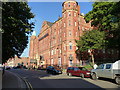
Homes in B12 0SB are characterised by a predominantly rental market rather than one driven by owner-occupiers. Only 20% of residents own their homes, meaning the vast majority of the 1,582 population rent their accommodation. This statistic creates a market where landlords and investors hold significant influence over property values and rental yields. The local housing stock consists almost exclusively of flats, which is typical for the urban core and the Bordesley and Highgate ward. You should expect to find compact, efficient living spaces designed for maximum use in an urban footprint. This flat-dominated landscape appeals to young professionals and shared housing arrangements common among the median age group of 22 years. The low home ownership rate indicates that securing a purchase property might be more difficult or competitive for first-time buyers in this specific postcode. Sellers here often deal with a buyer's market dominated by renters seeking short-term leases. Investment potential exists for those willing to navigate a rental-heavy environment where tenants value flexibility over long-term stability. The accommodation type data confirms that you will not find detached or semi-detached houses within this cluster. Understanding that 80% of residents do not own their home helps you gauge neighbourhood investment dynamics accurately.
House Prices in B12 0SB
No properties found in this postcode.
Energy Efficiency in B12 0SB
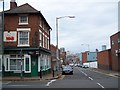
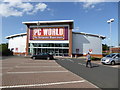
Daily life in B12 0SB offers immediate access to essential amenities within practical reach of residents. Five retail outlets serve the local population, including major supermarket chains such as Tesco Birmingham, Spar, and Morrisons Daily Bristol. These shops handle groceries and daily necessities without requiring long trips to the outskirts. Transport links are equally robust with five nearby railway stations serving commuters. Bordesley Railway Station, Birmingham Moor Street Railway Station, and Birmingham Snow Hill Railway Station provide direct rail connections to the city and beyond. For those preferring urban transit, five metro hubs are located nearby, including Grand Central New Street, Corporation Street, and Bull Street. These locations integrate seamlessly with your weekly routine for shopping or work. You can purchase food at Tesco Birmingham or Spar while awaiting a train at Bordesley Railway Station. The concentration of five retail and transport nodes ensures you do not need to venture far for basics. Living here means your daily errands are located just minutes away from your flat. The mix of supermarkets and stations caters to the fast-paced life of the area's 1,582 residents.
Amenities
Schools
Parents considering families in B12 0SB will find Chandos Primary School as the nearest educational institution. This primary school carries a satisfactory Ofsted rating, providing a baseline expectation for educational standards. There are no secondary schools specifically listed within the immediate vicinity of this postcode in the current data. Families must look beyond B12 0SB to find comprehensive school options for older children. The presence of only a primary school indicates that young families with school-age children may need to plan longer commutes for secondary education. You will find that most households do not live in this postcode until their children finish primary school. This short stay for local families aligns with the high proportion of rental homes and the dynamic demographic. The school data confirms that Chandos Primary School is the sole option within the defined reach for the B12 0SB cluster. Localised education choices are limited, so you should research neighbouring wards for secondary placements. The local primary sector is stable with a satisfactory rating, offering a functional start to schooling for toddlers and young children.
| Rank | School | Type | Entry gender | Ages |
|---|
Explore more schools in this area
Go to Schools tabDemographics
The community profile of B12 0SB reflects a young and active population. The median age here is just 22 years, indicating a significant number of young residents. While the most common age range for individuals is adults between 30 and 64 years, the low median suggests many younger people live in the cluster. Social housing makes up a small portion of the total population at 20% home ownership, meaning the majority of residents rent their properties. This high rental proportion points to a dynamic, transient community rather than established family households with deep local roots. The predominant ethnic group in the area is White, providing a clear demographic focus for the neighbourhood. Accommodation in B12 0SB consists almost entirely of flats, which aligns with the high density and urban setting of the postcode. This housing style supports the younger demographic and those seeking cheaper entry points into the Birmingham market. The low ownership rate of 20% suggests that residents may be more mobile or financially constrained compared to suburban neighbours. Families and those seeking to stay put for decades will find fewer long-term owners in the vicinity. The flat-based stock also means that interior space is often optimised for vertical living rather than sprawling grounds.
Household Size
Accommodation Type
Tenure
Ethnic Group
Religion
Household Composition
Age
Household Deprivation
NS-SEC
Explore more demographic insights in this area
Go to Demographics tabPlanning
Planning Constraints
- Flood RiskPremium
- Ramsar Wetland SitesPremium
- Area of Outstanding Natural BeautyPremium
- Protected Nature ReservePremium
- Protected WoodlandPremium