Area Overview for B11 3RZ
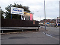
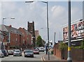
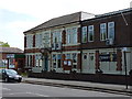
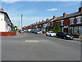
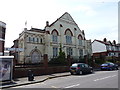
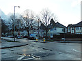
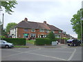
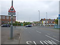
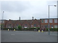
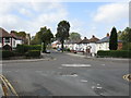
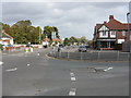
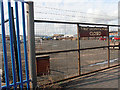
Photos of B11 3RZ
Area Information
B11 3RZ is a specific postcode area covering a small residential cluster within Sparkbrook and Balsall Heath East. This ward is an electoral division of Birmingham City Council located in the inner city to the south-east of the city centre. Although the entire ward contains 27,338 residents, the B11 3RZ cluster itself has a population of 2,148 people living across just 1.9 hectares. This creates a population density of 110,729 people per square kilometre, indicating a very compact urban environment. The area has a rich history dating back to the industrial boom period and later became a cultural hub for Commonwealth migrants after the 1960s. Balsall Heath was formally incorporated into Birmingham in 1891. Today, the neighbourhood is characterised as urban and diverse, with a younger age profile than the wider city. You will find a community driven by strong local spirit, with small businesses thriving along Stratford Road and Ladypool Road. For those considering living in B11 3RZ, the setting offers deep cultural roots, a high density of neighbours, and easy proximity to the main urban centre.
- Area Type
- Postcode
- Area Size
- 1.9 hectares
- Population
- 2148
- Population Density
- 5062 people/km²
The housing market in B11 3RZ is characterised by a predominance of houses and a strong culture of ownership. With 66 per cent of residents owning their homes, the area functions primarily as an owner-occupied space rather than a rental market. Most of the accommodation type found here consists of standalone houses, which aligns with the typical householder profile of the cluster. You may find properties ranging from first-time buyers moving for the high job potential to seasoned families seeking stability. The GVA of the wider ward is £368 million, with a GVA per head of £14,341. While this represents the 17th largest ward economy in the city, local unemployment rates remain above the Birmingham average. Small businesses drive the local retail scene, particularly along commercial hubs like Stratford Road and Ladypool Road. Buying a home in B11 3RZ often involves engaging with a neighbourhood where residents have invested heavily in their own properties. The market reflects a pragmatic approach where practical living needs meet a deep desire for community integration.
House Prices in B11 3RZ
Showing 1 properties
| Address | Type | Beds | Baths | Last Sale Price | Last Sale Date | |
|---|---|---|---|---|---|---|
| 20 Westwood Avenue, Birmingham, B11 3RZ | general_industrial | - | - | - | - |
Energy Efficiency in B11 3RZ
Daily life in B11 3RZ revolves around convenient access to major retail outlets and transport links. You have five retail outlets within easy reach, including Asda Sparkhill, Asda Small, and Aldi Sparkbrook, ensuring daily grocery needs are met without travel. There are five railway stations nearby, such as Tyseley Railway Station and Spring Road Railway Station, facilitating easy commutes. Five metro stations are also close by, including Corporation Street and Grand Central New Station. These transport hubs connect you to the wider city infrastructure efficiently. The local retail and transport mix supports a functional lifestyle where you save time on errands. The area is driven by small businesses and independent retail along Stratford Road and Ladypool Road, adding character to the mainstream chains. While there is no detailed data on specific leisure venues in the immediate cluster, the nearby Balsall Heath Park serves as a key community asset for the wider ward. The environment is urban and dynamic, serving a population that values proximity to services and cultural anchors.
Amenities
Schools
Families living in B11 3RZ have access to several educational institutions nearby. The most prominent option is Al-Furqan Primary School, which is a primary school receiving a good rating from Ofsted. This single named school provides a solid starting point for younger children within the cluster. For secondary education, families in the Sparkbrook and Balsall Heath East ward access a range of options, though specific secondary names are not detailed in the immediate B11 3RZ cluster data. The presence of a good-rated primary school ensures that foundation years of education are managed by a compliant and effective provider. The area's educational landscape is part of a larger network serving the diverse population of Sparkbrook and Balsall Heath East. Parents considering living in B11 3RZ should register interest in Al-Furqan Primary for younger ages while researching secondary placements for the wider ward. The mix of school types typically available in such estates supports both primary needs and broader educational pathways for the adult population ranging from 22 years upwards.
| Rank | School | Type | Entry gender | Ages |
|---|
Explore more schools in this area
Go to Schools tabDemographics
The community in B11 3RZ is defined by a relatively young resident base and a high rate of homeownership. The median age for the area is 22 years, while the most common age range is for adults between 30 and 64 years. Diverse groups make up the population, with Asian residents forming the predominant ethnic group. A significant majority of residents own their homes, with home ownership levels standing at 66 per cent. The majority of the local stock consists of houses rather than flats. This high ownership rate suggests a stable area where long-term residents are common. The ward is known as the most deprived in Birmingham and holds the 8th highest child poverty rate out of the city's 69 wards. Despite these economic challenges, the neighbourhood maintains a distinct cultural identity. The character is marked by a strong community spirit and entrepreneurial energy. Residents actively support independent shops and local organisations, creating a self-reliant local economy despite broader regional underinvestment.
Household Size
Accommodation Type
Tenure
Ethnic Group
Religion
Household Composition
Age
Household Deprivation
NS-SEC
Explore more demographic insights in this area
Go to Demographics tabPlanning
Planning Constraints
- Flood RiskPremium
- Ramsar Wetland SitesPremium
- Area of Outstanding Natural BeautyPremium
- Protected Nature ReservePremium
- Protected WoodlandPremium