Area Overview for B11 1RD
Photos of B11 1RD
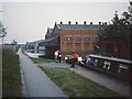
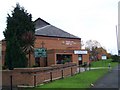
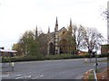

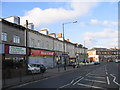

100 photos from this area
Area Information
Key information about the B11 1RD including its size, population, and administrative classification.
- Area Type
- Postcode
- Area Size
- 6571 m²
- Population
- 1791
- Population Density
- 4924 people/km²
House Prices in B11 1RD
26
Properties
£100,000
Average Sold Price
£50,000
Lowest Price
£150,000
Highest Price
Showing 26 properties
| Address | Type | Beds | Baths | Last Sale Price | Last Sale Date | |
|---|---|---|---|---|---|---|
| 145-A-149 Stratford Road, Sparkbrook, Birmingham, B11 1RD | Flat | - | - | £150,000 | Apr 2009 | |
| 117A Stratford Road, Sparkbrook, Birmingham, B11 1RD | Flat | - | - | £50,000 | Apr 2000 | |
| Hostel, 145-147-A Stratford Road, Sparkbrook, Birmingham, B11 1RD | Other | - | - | - | - | |
| Flat, 141B Stratford Road, Sparkbrook, Birmingham, B11 1RD | Flat | - | - | - | - | |
| Flat, 121 Stratford Road, Sparkbrook, Birmingham, B11 1RD | Flat | - | - | - | - | |
| Flat, 141A Stratford Road, Sparkbrook, Birmingham, B11 1RD | restaurant_cafe | - | - | - | - | |
| Flat, 133 Stratford Road, Sparkbrook, Birmingham, B11 1RD | Flat | - | - | - | - | |
| Flat Over, 145 And A Half, Stratford Road, Sparkbrook, Birmingham, B11 1RD | Flat | - | - | - | - | |
| Flat 3, 137-139 Stratford Road, Sparkbrook, Birmingham, B11 1RD | Flat | - | - | - | - | |
| Flat 1, 137-139 Stratford Road, Sparkbrook, Birmingham, B11 1RD | Flat | - | - | - | - |
Page 1 of 3
Energy Efficiency in B11 1RD
Amenities
Schools
| Rank | School | Type | Entry gender | Ages |
|---|
Explore more schools in this area
Go to Schools tabDemographics
Household Size
Family (3-5 people)
most common
Accommodation Type
Houses
most common
Tenure
45
majority
Ethnic Group
asian_total
most common
Religion
N/A
most common
Household Composition
N/A
most common
Age
47
median
Adults (30-64 years)
most common
Household Deprivation
N/A
with no deprivation
NS-SEC
12
in Lower managerial occupations
Explore more demographic insights in this area
Go to Demographics tabPlanning
Planning Constraints
- Flood RiskPremium
- Ramsar Wetland SitesPremium
- Area of Outstanding Natural BeautyPremium
- Protected Nature ReservePremium
- Protected WoodlandPremium