Area Overview for B11 1ND
Photos of B11 1ND
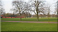
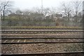
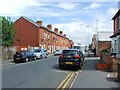
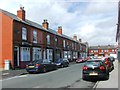
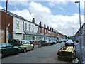
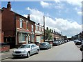
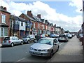
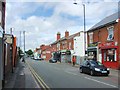
67 photos from this area
Area Information
Key information about the B11 1ND including its size, population, and administrative classification.
- Area Type
- Postcode
- Area Size
- 1.1 hectares
- Population
- 2832
- Population Density
- 12615 people/km²
House Prices in B11 1ND
53
Properties
£119,900
Average Sold Price
£38,000
Lowest Price
£240,000
Highest Price
Showing 53 properties
| Address | Type | Beds | Baths | Last Sale Price | Last Sale Date | |
|---|---|---|---|---|---|---|
| 148 Anderton Road, Birmingham, B11 1ND | Terraced | 3 | 1 | £150,000 | Jul 2024 | |
| 150 Anderton Road, Birmingham, B11 1ND | house | - | - | £240,000 | May 2021 | |
| 136 Anderton Road, Birmingham, B11 1ND | house | - | - | £71,500 | Apr 2021 | |
| 146 Anderton Road, Birmingham, B11 1ND | Terraced | 3 | 1 | £168,000 | Dec 2019 | |
| 144 Anderton Road, Birmingham, B11 1ND | Terraced | 3 | 1 | £163,500 | Nov 2019 | |
| 159 Anderton Road, Birmingham, B11 1ND | Terraced | - | - | £75,000 | Oct 2014 | |
| 161 Anderton Road, Birmingham, B11 1ND | house | - | - | £110,000 | Oct 2014 | |
| 154 Anderton Road, Birmingham, B11 1ND | house | - | - | £119,000 | Mar 2013 | |
| 163 Anderton Road, Birmingham, B11 1ND | Terraced | - | - | £64,000 | Nov 2002 | |
| 169 Anderton Road, Birmingham, B11 1ND | Terraced | - | - | £38,000 | Dec 1995 |
Page 1 of 6
Energy Efficiency in B11 1ND
Amenities
Schools
| Rank | School | Type | Entry gender | Ages |
|---|
Explore more schools in this area
Go to Schools tabDemographics
Household Size
Family (3-5 people)
most common
Accommodation Type
Houses
most common
Tenure
54
majority
Ethnic Group
asian_total
most common
Religion
N/A
most common
Household Composition
N/A
most common
Age
22
median
Adults (30-64 years)
most common
Household Deprivation
N/A
with no deprivation
NS-SEC
10
in Lower managerial occupations
Explore more demographic insights in this area
Go to Demographics tabPlanning
Planning Constraints
- Flood RiskPremium
- Ramsar Wetland SitesPremium
- Area of Outstanding Natural BeautyPremium
- Protected Nature ReservePremium
- Protected WoodlandPremium