Area Overview for B10 9ES
Photos of B10 9ES
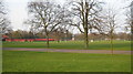
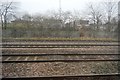
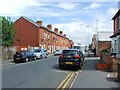
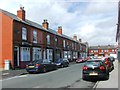
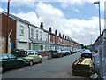
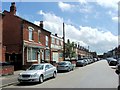
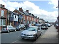
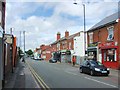
67 photos from this area
Area Information
Key information about the B10 9ES including its size, population, and administrative classification.
- Area Type
- Postcode
- Area Size
- 8491 m²
- Population
- 2683
- Population Density
- 11545 people/km²
House Prices in B10 9ES
31
Properties
£98,260
Average Sold Price
£20,355
Lowest Price
£218,000
Highest Price
Showing 31 properties
| Address | Type | Beds | Baths | Last Sale Price | Last Sale Date | |
|---|---|---|---|---|---|---|
| 2 Swanage Road, Birmingham, B10 9ES | Terraced | 3 | 1 | £218,000 | May 2024 | |
| 14 Swanage Road, Birmingham, B10 9ES | Terraced | 4 | 1 | £130,000 | Jul 2019 | |
| 58 Swanage Road, Birmingham, B10 9ES | Terraced | 3 | 1 | £95,000 | Jul 2008 | |
| 28 Swanage Road, Birmingham, B10 9ES | house | 3 | 1 | £121,000 | Jul 2003 | |
| 56 Swanage Road, Birmingham, B10 9ES | Terraced | 3 | 1 | £115,000 | Apr 2003 | |
| 32 Swanage Road, Birmingham, B10 9ES | house | - | - | £92,000 | Jan 2003 | |
| 60-62 Swanage Road, Birmingham, B10 9ES | Terraced | 3 | 1 | £122,500 | Oct 2002 | |
| 52 Swanage Road, Birmingham, B10 9ES | Terraced | 3 | 1 | £55,000 | Jun 2002 | |
| 34 Swanage Road, Birmingham, B10 9ES | house | - | - | £72,500 | Jun 2001 | |
| 38 Swanage Road, Birmingham, B10 9ES | Terraced | - | - | £20,355 | Aug 1998 |
Page 1 of 4
Energy Efficiency in B10 9ES
Amenities
Schools
| Rank | School | Type | Entry gender | Ages |
|---|
Explore more schools in this area
Go to Schools tabDemographics
Household Size
Family (3-5 people)
most common
Accommodation Type
Houses
most common
Tenure
47
majority
Ethnic Group
asian_total
most common
Religion
N/A
most common
Household Composition
N/A
most common
Age
22
median
Adults (30-64 years)
most common
Household Deprivation
N/A
with no deprivation
NS-SEC
12
in Lower managerial occupations
Explore more demographic insights in this area
Go to Demographics tabPlanning
Planning Constraints
- Flood RiskPremium
- Ramsar Wetland SitesPremium
- Area of Outstanding Natural BeautyPremium
- Protected Nature ReservePremium
- Protected WoodlandPremium