Area Overview for B10 0ED
Photos of B10 0ED
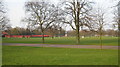
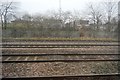
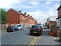
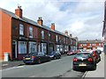
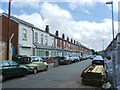
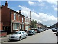
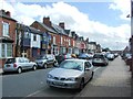
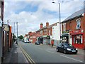
67 photos from this area
Area Information
Key information about the B10 0ED including its size, population, and administrative classification.
- Area Type
- Postcode
- Area Size
- 7918 m²
- Population
- 2683
- Population Density
- 11545 people/km²
House Prices in B10 0ED
25
Properties
£74,988
Average Sold Price
£21,350
Lowest Price
£149,500
Highest Price
Showing 25 properties
| Address | Type | Beds | Baths | Last Sale Price | Last Sale Date | |
|---|---|---|---|---|---|---|
| 45 Wordsworth Road, Birmingham, B10 0ED | house | - | - | £79,100 | Dec 2019 | |
| 59 Wordsworth Road, Birmingham, B10 0ED | Terraced | 4 | 2 | £149,500 | Aug 2007 | |
| 43 Wordsworth Road, Birmingham, B10 0ED | Terraced | - | - | £21,350 | Jun 2002 | |
| 39 Wordsworth Road, Birmingham, B10 0ED | house | - | - | £50,000 | Jan 2002 | |
| Flat, 71 Wordsworth Road, Birmingham, B10 0ED | Terraced | 4 | 1 | - | - | |
| 67 Wordsworth Road, Birmingham, B10 0ED | Terraced | 6 | 2 | - | - | |
| 55 WORDSWORTH ROAD, Birmingham, B10 0ED | Terraced | - | - | - | - | |
| 63 Wordsworth Road, Birmingham, B10 0ED | house | - | - | - | - | |
| 73 Wordsworth Road, Birmingham, B10 0ED | Maisonette | - | - | - | - | |
| 37 Wordsworth Road, Birmingham, B10 0ED | house | - | - | - | - |
Page 1 of 3
Energy Efficiency in B10 0ED
Amenities
Schools
| Rank | School | Type | Entry gender | Ages |
|---|
Explore more schools in this area
Go to Schools tabDemographics
Household Size
Family (3-5 people)
most common
Accommodation Type
Houses
most common
Tenure
47
majority
Ethnic Group
asian_total
most common
Religion
N/A
most common
Household Composition
N/A
most common
Age
22
median
Adults (30-64 years)
most common
Household Deprivation
N/A
with no deprivation
NS-SEC
12
in Lower managerial occupations
Explore more demographic insights in this area
Go to Demographics tabPlanning
Planning Constraints
- Flood RiskPremium
- Ramsar Wetland SitesPremium
- Area of Outstanding Natural BeautyPremium
- Protected Nature ReservePremium
- Protected WoodlandPremium