Area Overview for B10 0LT
Photos of B10 0LT


Area Information
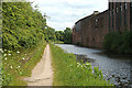
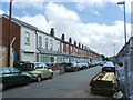
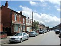
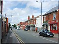
Living in B10 0LT, a small postcode area in Birmingham’s West Midlands, means inhabiting a compact urban enclave with a distinct character. This area, historically a heathland turned 19th-century terraced housing, now hosts a population of 2,683, predominantly adults aged 30-64. Its proximity to key transport routes—like the Grand Union Canal and the Birmingham and Oxford Junction Railway—reflects its role as a historic corridor between Birmingham and Coventry. The community is shaped by its past as a centre for industry, including the former Birmingham Small Arms factory, now a business park. Today, B10 0LT offers a mix of residential life with access to nearby amenities, including five rail stations and retail outlets. Its compact size means residents are close to schools, shops, and transport hubs, though the area’s character is defined by its terraced housing and diverse cultural influences, notably from Irish, Pakistani, and Indian communities. For buyers, this is a small, focused area where daily life is shaped by proximity to urban infrastructure and a legacy of industrial history.
- Area Type
- Postcode
- Area Size
- Not available
- Population
- 2683
- Population Density
- 11545 people/km²
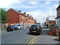
The property market in B10 0LT is characterised by 47% home ownership, with houses forming the predominant accommodation type. This suggests a mix of owner-occupied homes and rental properties, though the exact proportion of the latter is not specified. The area’s compact size means housing stock is limited, with terraced houses built from the 19th century onwards forming the core of the residential landscape. For buyers, this presents a challenge: the small area and its immediate surroundings may have limited options, particularly for those seeking larger properties or modern developments. The presence of houses rather than flats indicates a focus on family homes, which could appeal to buyers prioritising space and privacy. However, the lack of detailed data on property prices or availability means potential buyers should consider the area’s limited scale when assessing long-term value or investment potential.
House Prices in B10 0LT
No properties found in this postcode.
Energy Efficiency in B10 0LT
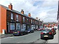
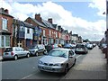
The lifestyle in B10 0LT is shaped by its access to nearby amenities, including five retail outlets like Morrisons Bordesley, Asda Small, and Iceland Birmingham. These shops offer convenience for daily errands, from groceries to household goods. The presence of five rail stations and five metro stops—such as Grand Central New Street—ensures easy movement within the city, supporting both commuters and those who rely on public transport. While the area’s compact size means parks or green spaces are not explicitly listed, its historical roots as a heathland suggest potential for open, accessible spaces. The mix of retail, transport, and proximity to schools creates a practical, urban lifestyle, ideal for those prioritising convenience over expansive natural landscapes. For residents, the balance of amenities and transport options makes daily life efficient, though the area’s small footprint may limit options for those seeking larger recreational areas.
Amenities
Schools
Residents of B10 0LT have access to two notable schools within practical reach. Somerville Primary (NC) School, a primary institution with a good Ofsted rating, serves the local community with a focus on foundational education. Nearby, Darul Uloom Islamic High School, an independent school also rated good by Ofsted, offers a distinct curriculum aligned with Islamic values. The combination of a state-funded primary school and an independent secondary institution provides families with options tailored to their educational preferences. The presence of two schools with strong ratings suggests a commitment to quality education, though the exact catchment areas or student numbers are not detailed. For families, this mix of school types may reduce the need to travel far for schooling, supporting a convenient lifestyle in the area.
| Rank | School | Type | Entry gender | Ages |
|---|
Explore more schools in this area
Go to Schools tabDemographics
B10 0LT’s population of 2,683 is skewed toward adults aged 30-64, with a median age of 22, suggesting a mix of younger residents and working-age families. Home ownership here is 47%, indicating a balance between owner-occupied properties and rental stock. The accommodation type is predominantly houses, though the exact number of flats or other dwellings is not specified. The area’s predominant ethnic group is Asian_total, reflecting historical immigration patterns, including post-WWII communities from Pakistan, India, and the West Indies. This diversity shapes the social fabric, with cultural influences evident in local institutions such as Darul Uloom Islamic High School. While no deprivation data is provided, the presence of independent schools and multiple retail outlets suggests a community with access to resources. However, the median age and ownership rate hint at a population that may be stable but not rapidly growing.
Household Size
Accommodation Type
Tenure
Ethnic Group
Religion
Household Composition
Age
Household Deprivation
NS-SEC
Explore more demographic insights in this area
Go to Demographics tabPlanning
Planning Constraints
- Flood RiskPremium
- Ramsar Wetland SitesPremium
- Area of Outstanding Natural BeautyPremium
- Protected Nature ReservePremium
- Protected WoodlandPremium