Area Overview for B1 2UN
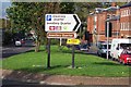
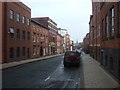
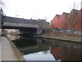
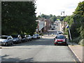
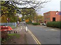
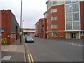
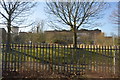
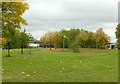
Photos of B1 2UN


Area Information
B1 2UN is a compact postcode area in central Birmingham, England, encompassing a small residential cluster within the Ladywood Ward. With a population of 1,107 spread across just 3,747 square metres, the area is densely populated, reflecting its role as an inner-city district. Historically rooted in medieval woodland, Ladywood has evolved into a hub of urban life, adjacent to key landmarks like Birmingham’s Council House and Town Hall. Daily life here is shaped by proximity to the city centre, with easy access to retail, transport, and cultural spaces. The area’s character is defined by its mix of historic and modern infrastructure, though its legacy of social challenges persists. Residents benefit from being near major transport links and city amenities, but the high population density and urban setting mean living here requires navigating the dynamics of a bustling inner-city environment.
- Area Type
- Postcode
- Area Size
- 3747 m²
- Population
- 1107
- Population Density
- 6531 people/km²
The property market in B1 2UN is characterised by a low rate of home ownership (37%) and a prevalence of flats. This suggests the area is more rental-focused than owner-occupied, likely due to its history of social housing and limited availability of larger properties. The small area size and high population density mean housing stock is constrained, with limited scope for expansion or new developments. For buyers, this implies a niche market with fewer options, though proximity to central Birmingham’s amenities may offset the lack of choice. The predominance of flats also means properties are likely smaller, with potential limitations on space and privacy. Prospective buyers should consider the area’s urban setting and the practicalities of living in a high-density environment.
House Prices in B1 2UN
No properties found in this postcode.
Energy Efficiency in B1 2UN
Living in B1 2UN offers access to a range of amenities within practical reach. Retail options include major chains like Tesco Hockley and Spar, providing convenience for everyday shopping. The area’s proximity to rail and metro stations, such as Five Ways and Centenary Square, ensures efficient travel to the city’s cultural and commercial hubs. While the data does not mention parks or leisure facilities, the area’s historic landmarks, such as Birmingham’s Town Hall, add to its urban charm. The high density of amenities reflects the area’s role as a central node in Birmingham’s infrastructure, though the lack of green spaces or recreational facilities may be a consideration for some residents.
Amenities
Schools
The nearest school to B1 2UN is Jewellery Quarter Academy, an academy with an Ofsted rating of inadequate. This rating indicates significant concerns about the quality of education and school performance. Families seeking schools in the area must consider this rating, as no other schools are listed in the data. The presence of only one school, coupled with its poor evaluation, may necessitate looking beyond the immediate vicinity for alternative educational options. This could impact the appeal of the area for families prioritising strong local schools. The lack of diversity in school types further limits choices, highlighting a potential challenge for residents reliant on nearby education provision.
| Rank | School | Type | Entry gender | Ages |
|---|
Explore more schools in this area
Go to Schools tabDemographics
The population of B1 2UN has a median age of 47, with the majority of residents aged between 30 and 64. This suggests a community of middle-aged adults, many of whom may be working professionals or long-term residents. Home ownership is relatively low at 37%, indicating that most households are renters. The predominant accommodation type is flats, reflecting the area’s history of post-war housing developments and subsequent redevelopment. The predominant ethnic group is White, though no specific data on diversity or deprivation levels is provided. The age profile and housing stock suggest a stable but not particularly young or transient population. However, the lack of data on income or deprivation means the full picture of quality of life remains incomplete.
Household Size
Accommodation Type
Tenure
Ethnic Group
Religion
Household Composition
Age
Household Deprivation
NS-SEC
Explore more demographic insights in this area
Go to Demographics tabPlanning
Planning Constraints
- Flood RiskPremium
- Ramsar Wetland SitesPremium
- Area of Outstanding Natural BeautyPremium
- Protected Nature ReservePremium
- Protected WoodlandPremium