Area Overview for B1 2UG
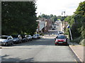
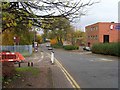
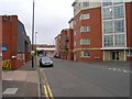
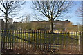
Photos of B1 2UG


Area Information
Living in B1 2UG means residing in a compact, inner-city postcode nestled within Birmingham’s Ladywood Ward. This area, with a population of 1922, is part of a historically significant district that once included medieval woodlands and later became a focus of post-war redevelopment. Its proximity to landmarks like Birmingham’s Council House and Town Hall underscores its central role in the city’s administrative and cultural life. The area’s character is shaped by its dense urban fabric, with a mix of older housing stock and post-1960s developments. Residents here are predominantly adults aged 30–64, reflecting a community rooted in working-age populations. While the area lacks green spaces or rural tranquillity, its location near key transport hubs and retail centres offers convenience for those prioritising accessibility over seclusion. The presence of institutions like the BOA Stage and Screen Production Academy hints at a focus on vocational and higher education, though broader schooling options are limited. For buyers, B1 2UG presents a small, defined cluster of properties in a historically complex, centrally located part of Birmingham.
- Area Type
- Postcode
- Area Size
- Not available
- Population
- 1922
- Population Density
- 6792 people/km²
The property market in B1 2UG is characterised by a low rate of home ownership—just 18%—indicating that the area is not a strong market for owner-occupied homes. The predominant accommodation type is flats, a legacy of mid-20th-century housing projects that were later partially demolished. This suggests a housing stock that is largely rental-focused, with limited scope for long-term investment or family home purchases. The small size of the postcode area means that property options are constrained, and buyers seeking owner-occupied properties may find the market challenging. For those considering the area, the availability of flats may appeal to renters or those prioritising affordability over property ownership. However, the lack of data on property prices or recent developments means that potential buyers must weigh the limited stock against the area’s central location and proximity to transport links.
House Prices in B1 2UG
No properties found in this postcode.
Energy Efficiency in B1 2UG
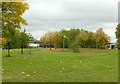
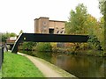
The lifestyle in B1 2UG is defined by its urban density and proximity to Birmingham’s central amenities. Within practical reach are five retail outlets, including Tesco Hockley and Spar, offering everyday shopping needs. The area’s transport network, with multiple rail and metro stations, ensures easy access to the city’s cultural and commercial hubs. While there are no parks or recreational spaces listed in the data, the presence of landmarks like the Council House and Town Hall suggests a focus on civic and administrative functions. The area’s character is shaped by its history of redevelopment, with a mix of older buildings and post-war housing. For residents, the convenience of nearby transport and retail is balanced by the absence of green spaces or leisure facilities, making it suitable for those who prioritise connectivity over natural environments.
Amenities
Schools
The only school listed near B1 2UG is the BOA Stage and Screen Production Academy, a sixth-form college offering vocational and higher education. No primary or secondary schools are mentioned in the data, which means families with younger children may need to look beyond the immediate area for schooling options. The presence of a sixth-form institution suggests a focus on post-16 education, potentially catering to students pursuing technical or creative pathways. However, the absence of primary or secondary schools in the data highlights a gap in the local educational infrastructure. For families requiring a full range of schooling, the area may not be ideal unless they are prepared to commute to nearby districts. The single listed school does not provide an Ofsted rating, so its quality remains unverified.
| Rank | School | Type | Entry gender | Ages |
|---|
Explore more schools in this area
Go to Schools tabDemographics
The demographic profile of B1 2UG reveals a community predominantly composed of adults aged 30–64, with a median age of 47. Home ownership here is notably low, at 18%, indicating that most residents are renters rather than property owners. The accommodation type is largely flats, reflecting a housing stock shaped by post-war high-rise developments and subsequent redevelopments. The predominant ethnic group is Black_total, a detail that contextualises the area’s social and cultural makeup. While no specific deprivation data is provided, the low home ownership rate and reliance on rental housing suggest a community that may face economic pressures or transient living patterns. The age range of residents implies a population largely in employment, though the absence of data on employment rates or income levels leaves gaps in understanding the full picture of quality of life.
Household Size
Accommodation Type
Tenure
Ethnic Group
Religion
Household Composition
Age
Household Deprivation
NS-SEC
Explore more demographic insights in this area
Go to Demographics tabPlanning
Planning Constraints
- Flood RiskPremium
- Ramsar Wetland SitesPremium
- Area of Outstanding Natural BeautyPremium
- Protected Nature ReservePremium
- Protected WoodlandPremium