Area Overview for WR11 7QA
Photos of WR11 7QA
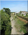

![Lower Fields Farm [2] in WR11 7QA](https://images.propbar.co.uk/images/geograph/29/05/2905564_120.jpg)
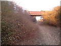
![Once were trains [1] in WR11 7QA](https://images.propbar.co.uk/images/geograph/29/05/2905573_120.jpg)
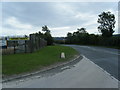
![Once were trains [2] in WR11 7QA](https://images.propbar.co.uk/images/geograph/29/05/2905579_120.jpg)
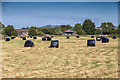
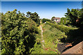
![Once were trains [3] in WR11 7QA](https://images.propbar.co.uk/images/geograph/29/05/2905638_120.jpg)
27 photos from this area
Area Information
Key information about the WR11 7QA including its size, population, and administrative classification.
- Area Type
- Postcode
- Area Size
- 3.6 km²
- Population
- 1689
- Population Density
- 51 people/km²
House Prices in WR11 7QA
23
Properties
£910,786
Average Sold Price
£310,000
Lowest Price
£3,150,000
Highest Price
Showing 23 properties
| Address | Type | Beds | Baths | Last Sale Price | Last Sale Date | |
|---|---|---|---|---|---|---|
| Station House, Weston Road, Bretforton, WR11 7QA | house | - | - | £730,000 | Jul 2024 | |
| New Larkborough Farmhouse, Weston Road, Bretforton, WR11 7QA | house | 5 | - | £820,000 | Jan 2022 | |
| Saintbury Grounds Farm, Weston Road, Saintbury, WR11 7QA | Bungalow | - | - | £3,150,000 | Aug 2018 | |
| The Pond House, Weston Road, Saintbury, WR11 7QA | Detached | 5 | 3 | £627,500 | Aug 2018 | |
| 2, Saintbury Grounds, Weston Road, Saintbury, WR11 7QA | Semi-detached | 3 | 1 | £310,000 | Feb 2016 | |
| Lower Fields House, Weston Road, Saintbury, WR11 7QA | Detached | 4 | - | £360,000 | Mar 2014 | |
| 4, Saintbury Grounds, Weston Road, Saintbury, WR11 7QA | Semi-detached | - | - | £378,000 | Sep 2006 | |
| West Acre, Weston Road, Bretforton, WR11 7QA | Bungalow | 6 | 4 | - | - | |
| New Larkborough Farm Barn, Weston Road, Bretforton, WR11 7QA | Detached | 5 | - | - | - | |
| The Flat At, West Acre, Weston Road, Bretforton, WR11 7QA | Flat | - | - | - | - |
Page 1 of 3
Energy Efficiency in WR11 7QA
Amenities
Schools
| Rank | School | Type | Entry gender | Ages |
|---|
Explore more schools in this area
Go to Schools tabDemographics
Household Size
Two person
most common
Accommodation Type
Houses
most common
Tenure
73
majority
Ethnic Group
White
most common
Religion
N/A
most common
Household Composition
N/A
most common
Age
47
median
Adults (30-64 years)
most common
Household Deprivation
N/A
with no deprivation
NS-SEC
38
in Lower managerial occupations
Explore more demographic insights in this area
Go to Demographics tabPlanning
Planning Constraints
- Flood RiskPremium
- Ramsar Wetland SitesPremium
- Area of Outstanding Natural BeautyPremium
- Protected Nature ReservePremium
- Protected WoodlandPremium