Area Overview for WR11 7HW
Photos of WR11 7HW
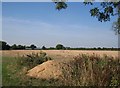
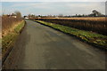
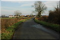
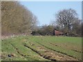
14 photos from this area
Area Information
Key information about the WR11 7HW including its size, population, and administrative classification.
- Area Type
- Postcode
- Area Size
- 1.3 km²
- Population
- 1356
- Population Density
- 571 people/km²
House Prices in WR11 7HW
70
Properties
£358,198
Average Sold Price
£85,000
Lowest Price
£1,190,000
Highest Price
Showing 70 properties
| Address | Type | Beds | Baths | Last Sale Price | Last Sale Date | |
|---|---|---|---|---|---|---|
| 2 Weston Road, Bretforton, WR11 7HW | Detached | 3 | 2 | £245,000 | Aug 2024 | |
| The Old Vicarage, 19 Weston Road, Bretforton, WR11 7HW | Detached | 6 | 3 | £1,190,000 | Oct 2023 | |
| Westfield Farm, 39 Weston Road, Bretforton, WR11 7HW | Detached | 4 | 2 | £741,500 | Jun 2021 | |
| Bardon, 15 Weston Road, Bretforton, WR11 7HW | Bungalow | - | - | £410,000 | Jun 2021 | |
| 6 Weston Road, Bretforton, WR11 7HW | Detached | 4 | 4 | £758,500 | Sep 2018 | |
| Redlands, 84 Weston Road, Bretforton, WR11 7HW | Semi-detached | 4 | 1 | £350,000 | Mar 2018 | |
| Millington House, 30 Weston Road, Bretforton, WR11 7HW | Detached | 3 | 1 | £385,000 | Sep 2017 | |
| New Yats, 3 Weston Road, Bretforton, WR11 7HW | Detached | 3 | 2 | £445,000 | Nov 2015 | |
| 106 Weston Road, Bretforton, WR11 7HW | house | 4 | - | £215,000 | May 2015 | |
| 65 Weston Road, Bretforton, WR11 7HW | house | 3 | - | £399,000 | Sep 2014 |
Page 1 of 7
Energy Efficiency in WR11 7HW
Amenities
Schools
| Rank | School | Type | Entry gender | Ages |
|---|
Explore more schools in this area
Go to Schools tabDemographics
Household Size
Two person
most common
Accommodation Type
Houses
most common
Tenure
68
majority
Ethnic Group
White
most common
Religion
N/A
most common
Household Composition
N/A
most common
Age
47
median
Adults (30-64 years)
most common
Household Deprivation
N/A
with no deprivation
NS-SEC
31
in Lower managerial occupations
Explore more demographic insights in this area
Go to Demographics tabPlanning
Planning Constraints
- Flood RiskPremium
- Ramsar Wetland SitesPremium
- Area of Outstanding Natural BeautyPremium
- Protected Nature ReservePremium
- Protected WoodlandPremium