Area Overview for GL55 6QW
Photos of GL55 6QW
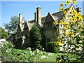
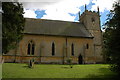
![Buckle Street Junction [1] in GL55 6QW](https://images.propbar.co.uk/images/geograph/20/38/2038645_120.jpg)
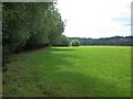
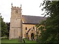
![Buckle Street junction [2] in GL55 6QW](https://images.propbar.co.uk/images/geograph/20/38/2038652_120.jpg)
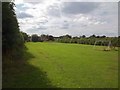
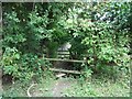
![Buckle Street junction [3] in GL55 6QW](https://images.propbar.co.uk/images/geograph/20/38/2038660_120.jpg)
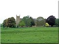
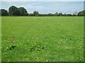
![Buckle Street junction [4] in GL55 6QW](https://images.propbar.co.uk/images/geograph/20/38/2038666_120.jpg)
68 photos from this area
Area Information
Key information about the GL55 6QW including its size, population, and administrative classification.
- Area Type
- Postcode
- Area Size
- 20.8 hectares
- Population
- 1689
- Population Density
- 51 people/km²
House Prices in GL55 6QW
8
Properties
£209,667
Average Sold Price
£124,000
Lowest Price
£330,000
Highest Price
Showing 8 properties
| Address | Type | Beds | Baths | Last Sale Price | Last Sale Date | |
|---|---|---|---|---|---|---|
| 3 Chapel Lane, Weston Subedge, GL55 6QW | house | - | - | £330,000 | Jul 2019 | |
| 5 Chapel Lane, Weston Subedge, GL55 6QW | Semi-detached | 2 | - | £175,000 | Mar 2014 | |
| 4 Chapel Lane, Weston Subedge, GL55 6QW | house | - | - | £124,000 | Jul 1998 | |
| 2 Chapel Lane, Weston Subedge, GL55 6QW | house | - | - | - | - | |
| 2A Chapel Lane, Weston Subedge, GL55 6QW | Detached | - | - | - | - | |
| 2B Chapel Lane, Weston Subedge, GL55 6QW | Detached | - | - | - | - | |
| 1 Chapel Lane, Weston Subedge, GL55 6QW | Semi-detached | - | - | - | - | |
| 6 Chapel Lane, Weston Subedge, GL55 6QW | Semi-detached | - | - | - | - |
Energy Efficiency in GL55 6QW
Amenities
Schools
| Rank | School | Type | Entry gender | Ages |
|---|
Explore more schools in this area
Go to Schools tabDemographics
Household Size
Two person
most common
Accommodation Type
Houses
most common
Tenure
73
majority
Ethnic Group
White
most common
Religion
N/A
most common
Household Composition
N/A
most common
Age
47
median
Adults (30-64 years)
most common
Household Deprivation
N/A
with no deprivation
NS-SEC
38
in Lower managerial occupations
Explore more demographic insights in this area
Go to Demographics tabPlanning
Planning Constraints
- Flood RiskPremium
- Ramsar Wetland SitesPremium
- Area of Outstanding Natural BeautyPremium
- Protected Nature ReservePremium
- Protected WoodlandPremium